Area Overview for BS5 6TL
Photos of BS5 6TL
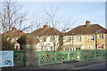
99 photos from this area
Area Information
Key information about the BS5 6TL including its size, population, and administrative classification.
- Area Type
- Postcode
- Area Size
- 1.3 hectares
- Population
- 2200
- Population Density
- 2856 people/km²
House Prices in BS5 6TL
29
Properties
£187,748
Average Sold Price
£50,000
Lowest Price
£425,000
Highest Price
Showing 29 properties
| Address | Type | Beds | Baths | Last Sale Price | Last Sale Date | |
|---|---|---|---|---|---|---|
| 59 Cottrell Road, Eastville, Bristol, BS5 6TL | Semi-detached | 3 | 1 | £385,000 | Sep 2025 | |
| 61 Cottrell Road, Eastville, Bristol, BS5 6TL | Semi-detached | 3 | 1 | £425,000 | Aug 2025 | |
| 72 Cottrell Road, Eastville, Bristol, BS5 6TL | Semi-detached | 3 | 1 | £250,000 | Oct 2022 | |
| 50 Cottrell Road, Eastville, Bristol, BS5 6TL | Semi-detached | 4 | 2 | £420,000 | Oct 2021 | |
| 71 Cottrell Road, Eastville, Bristol, BS5 6TL | Semi-detached | 3 | 1 | £250,000 | Jun 2021 | |
| 48 Cottrell Road, Eastville, Bristol, BS5 6TL | Semi-detached | 3 | 1 | £253,000 | Oct 2019 | |
| 68 Cottrell Road, Eastville, Bristol, BS5 6TL | house | - | - | £99,000 | Feb 2017 | |
| 51 Cottrell Road, Eastville, Bristol, BS5 6TL | Semi-detached | - | - | £190,000 | Aug 2016 | |
| 70 Cottrell Road, Eastville, Bristol, BS5 6TL | house | 3 | 1 | £176,000 | Oct 2015 | |
| 58 Cottrell Road, Eastville, Bristol, BS5 6TL | Semi-detached | 3 | - | £200,000 | Jun 2014 |
Page 1 of 3
Energy Efficiency in BS5 6TL
Amenities
Schools
| Rank | School | Type | Entry gender | Ages |
|---|
Explore more schools in this area
Go to Schools tabDemographics
Household Size
Family (3-5 people)
most common
Accommodation Type
Houses
most common
Tenure
73
majority
Ethnic Group
White
most common
Religion
N/A
most common
Household Composition
N/A
most common
Age
47
median
Adults (30-64 years)
most common
Household Deprivation
N/A
with no deprivation
NS-SEC
32
in Lower managerial occupations
Explore more demographic insights in this area
Go to Demographics tabPlanning
Planning Constraints
- Flood RiskPremium
- Ramsar Wetland SitesPremium
- Area of Outstanding Natural BeautyPremium
- Protected Nature ReservePremium
- Protected WoodlandPremium