Area Overview for BS5 0GB
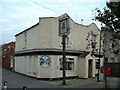
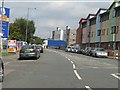
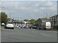
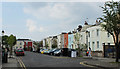
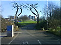
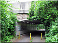
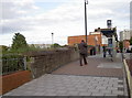
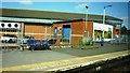
Photos of BS5 0GB
Area Information
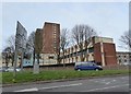
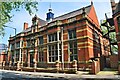
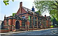
BS5 0GB lies in the heart of east Bristol, within the Lawrence Hill electoral ward, a historically rich area blending medieval heritage with modern urban life. This small postcode cluster covers 4,452 m² and is densely populated, housing 2,774 residents. The area encompasses parts of Barton Hill, St Philips Marsh, and Redcliffe, with proximity to Broadmead’s shopping district and the A420/A4320 junctions. Originally named for St Lawrence’s Hospital, a 12th-century leper house, the ward now features mid-20th-century tower blocks like Kingsmarsh House and revitalisation plans for its high street. Daily life here is shaped by its transport links: nearby railway stations, ferry terminals, and the Bristol and Bath Railway Path offer easy access to the city and beyond. While the area’s compact size limits expansion, its strategic location near Bristol Temple Meads and the M32 motorway makes it a hub for commuters. The mix of historic architecture and planned redevelopment hints at a community navigating the tension between preservation and progress.
- Area Type
- Postcode
- Area Size
- 4452 m²
- Population
- Not available
- Population Density
- Not available
The property market in BS5 0GB is characterised by a low home ownership rate—only 20% of residents own their homes—indicating a strong rental market. The area’s housing stock is predominantly flats, a legacy of mid-20th-century high-rise developments like Kingsmarsh House and Baynton Houses. This suggests limited availability of owner-occupied properties, particularly larger homes. Buyers seeking property here may find a constrained market, with options focused on flats rather than detached or semi-detached homes. The small area size means competition for available properties, though proximity to transport links and amenities could offset this. For those considering investment, the rental demand is likely steady, though the high population density may mean limited scope for expansion or redevelopment.
House Prices in BS5 0GB
No properties found in this postcode.
Energy Efficiency in BS5 0GB
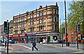
Daily life in BS5 0GB is shaped by its proximity to retail, transport, and leisure hubs. The area includes five retail outlets, such as Lidl Easton and Tesco Redfield, providing essential shopping. Nearby rail, ferry, and metro stations connect residents to Bristol’s cultural and commercial centres. The high street near Lawrence Hill Railway Station is slated for redevelopment into a vibrant town centre with housing, workspaces, and community amenities, hinting at future growth. The Bristol and Bath Railway Path offers scenic routes for walking or cycling. While the area’s compact size limits green spaces, its transport links and planned revitalisation suggest a lifestyle focused on convenience and connectivity, blending urban living with access to broader opportunities.
Amenities
Schools
BS5 0GB is served by a range of educational institutions, including Spring Woods Nursery School, which provides early years education, and Bannerman Road Community School, a primary school offering foundational learning. The E-Act Bannerman Road Community Academy, an academy with a ‘good’ Ofsted rating, caters to secondary education. This mix of nursery, primary, and academy schools ensures families have options from early childhood through to adolescence. The presence of a rated ‘good’ secondary school is a significant draw for families prioritising quality education. However, the area’s small size means schools are concentrated within a short distance, which could be both convenient and competitive for admissions.
| Rank | School | Type | Entry gender | Ages |
|---|
Explore more schools in this area
Go to Schools tabDemographics
BS5 0GB’s population of 2,774 is densely packed at 623,052 people per km², reflecting a small, tightly knit community. The median age of 47 indicates a mature demographic, with the majority aged 30–64. Only 20% of residents own their homes, suggesting a rental market dominated by flats, which are the primary accommodation type. The predominant ethnic group is Black residents, highlighting the area’s cultural diversity. This density and age profile suggest a community of long-term residents, many of whom may be professionals or retirees. The low home ownership rate could indicate limited housing stock or a preference for renting, which may affect property prices and availability. Despite the high population density, the area’s infrastructure and amenities are designed to serve a compact, active population.
Household Size
Accommodation Type
Tenure
Ethnic Group
Religion
Household Composition
Age
Household Deprivation
NS-SEC
Explore more demographic insights in this area
Go to Demographics tabPlanning
Planning Constraints
- Flood RiskPremium
- Ramsar Wetland SitesPremium
- Area of Outstanding Natural BeautyPremium
- Protected Nature ReservePremium
- Protected WoodlandPremium