Area Overview for BS5 0DA
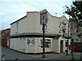
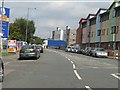
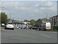
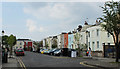
Photos of BS5 0DA

Area Information
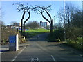
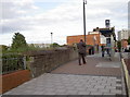
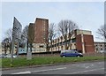
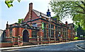
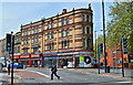
BS5 0DA is a compact residential postcode in east Bristol, encompassing parts of Lawrence Hill, Easton, and Broadmead. Covering just 7,389 square metres, it is densely populated, with 2,774 residents squeezed into a space that includes historic landmarks and modern infrastructure. The area’s name traces back to St Lawrence’s Hospital, a medieval leper house founded by King John, now long gone but remembered in the streets and landmarks around the Lawrence Hill roundabout. Daily life here is shaped by proximity to transport hubs, including multiple rail stations and the Bristol and Bath Railway Path, which runs through the southern part of the ward. The Broadmead shopping area is a short walk away, offering retail and dining options. While the area is small, it is rich in connectivity, with five rail stations within reach, including Stapleton Road and Bristol Temple Meads. This makes it a convenient base for commuters, though the high population density and limited housing stock mean the community is tightly knit, with a focus on shared spaces and local amenities.
- Area Type
- Postcode
- Area Size
- 7389 m²
- Population
- Not available
- Population Density
- Not available
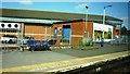
The property market in BS5 0DA is characterised by a low home ownership rate of 20%, meaning the area is predominantly a rental market. The accommodation type is largely flats, which are typical in high-density urban areas. This suggests limited availability of owner-occupied homes, with most properties being let to tenants. The small size of the postcode and the prevalence of flats indicate that the housing stock is concentrated, with little scope for expansion. For buyers, this means competition for the few available properties, which are likely to be flats in multi-unit buildings. The area’s proximity to transport links, including rail and ferry services, may make it attractive to commuters, but the high population density and limited housing options could deter those seeking larger homes or long-term ownership. The mix of older and newer housing, including mid-1960s tower blocks, reflects a blend of architectural styles and varying property conditions.
House Prices in BS5 0DA
Showing 1 properties
| Address | Type | Beds | Baths | Last Sale Price | Last Sale Date | |
|---|---|---|---|---|---|---|
| Berkeley House, Croydon Street, Easton, Bristol, BS5 0DA | office_workshop | - | - | - | - |
Energy Efficiency in BS5 0DA
Residents of BS5 0DA have access to a range of amenities within practical reach. The area is served by five retail outlets, including Lidl Easton and Tesco Redfield, providing everyday shopping options. The high street near the train station is undergoing revitalisation to include housing, workspaces, and community facilities, suggesting potential for future development. The presence of multiple rail stations and ferry terminals enhances mobility, while the proximity to the Broadmead shopping area offers additional retail and dining choices. The Bristol and Bath Railway Path allows for leisurely walks or bike rides, adding to the area’s appeal for active lifestyles. Though the area is small, its mix of retail, transport, and green spaces offers a balance of convenience and accessibility.
Amenities
Schools
Residents of BS5 0DA have access to a range of educational institutions, including Spring Woods Nursery School, which provides early years education, and Bannerman Road Community School, a primary school serving local children. For secondary education, E-Act Bannerman Road Community Academy is a notable option, rated ‘good’ by Ofsted. This mix of nursery, primary, and academy schools ensures that families can access education at multiple stages without needing to travel far. The presence of a school rated ‘good’ is a positive indicator for parents seeking quality education for their children. However, the limited number of schools in the area means that families may need to consider proximity to other schools in nearby postcodes. The schools in BS5 0DA cater to a diverse community, reflecting the area’s demographic profile.
| Rank | School | Type | Entry gender | Ages |
|---|
Explore more schools in this area
Go to Schools tabDemographics
The population of BS5 0DA is 2,774, with a median age of 47, indicating a mature demographic. The most common age group is adults aged 30–64, suggesting a mix of professionals and families. Home ownership is low at 20%, meaning the majority of residents are renters, likely due to the prevalence of flats as the primary accommodation type. The predominant ethnic group is Black residents, reflecting the area’s diversity. The high population density of 375,426 people per square kilometre highlights the compact nature of the postcode, which can create a sense of community but also pressure on local services. For buyers, this density means limited availability of owner-occupied properties, with most housing stock being rented out. The age profile suggests a stable, established population, though the low home ownership rate may indicate a transient or younger demographic.
Household Size
Accommodation Type
Tenure
Ethnic Group
Religion
Household Composition
Age
Household Deprivation
NS-SEC
Explore more demographic insights in this area
Go to Demographics tabPlanning
Planning Constraints
- Flood RiskPremium
- Ramsar Wetland SitesPremium
- Area of Outstanding Natural BeautyPremium
- Protected Nature ReservePremium
- Protected WoodlandPremium