Area Overview for BS41 9AE
Photos of BS41 9AE
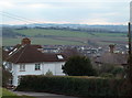
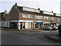
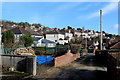
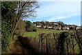
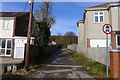
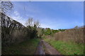

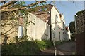
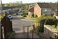
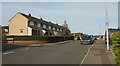
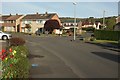
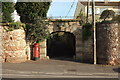
54 photos from this area
Area Information
Key information about the BS41 9AE including its size, population, and administrative classification.
- Area Type
- Postcode
- Area Size
- 1.0 hectares
- Population
- 2673
- Population Density
- 1435 people/km²
House Prices in BS41 9AE
29
Properties
£359,500
Average Sold Price
£50,000
Lowest Price
£575,000
Highest Price
Showing 29 properties
| Address | Type | Beds | Baths | Last Sale Price | Last Sale Date | |
|---|---|---|---|---|---|---|
| 107 Weston Road, Long Ashton, BS41 9AE | Terraced | 2 | 1 | £350,000 | Aug 2025 | |
| 97 Weston Road, Long Ashton, BS41 9AE | Terraced | 4 | 2 | £435,000 | Nov 2022 | |
| 133 Weston Road, Long Ashton, BS41 9AE | house | 3 | - | £512,500 | Mar 2021 | |
| 119 Weston Road, Long Ashton, BS41 9AE | Detached | 4 | 3 | £565,000 | Aug 2019 | |
| 129 Weston Road, Long Ashton, BS41 9AE | Terraced | 4 | 2 | £352,500 | Aug 2018 | |
| 131 Weston Road, Long Ashton, BS41 9AE | Detached | 4 | 3 | £575,000 | Jun 2018 | |
| 91A Weston Road, Long Ashton, BS41 9AE | Detached | 4 | 3 | £545,000 | Aug 2016 | |
| 89 Weston Road, Long Ashton, BS41 9AE | Detached | 4 | 3 | £475,000 | Jun 2016 | |
| 95 Weston Road, Long Ashton, BS41 9AE | house | - | - | £460,500 | Mar 2016 | |
| 99 Weston Road, Long Ashton, BS41 9AE | house | - | - | £260,000 | Aug 2012 |
Page 1 of 3
Energy Efficiency in BS41 9AE
Amenities
Schools
| Rank | School | Type | Entry gender | Ages |
|---|
Explore more schools in this area
Go to Schools tabDemographics
Household Size
Family (3-5 people)
most common
Accommodation Type
Houses
most common
Tenure
76
majority
Ethnic Group
White
most common
Religion
N/A
most common
Household Composition
N/A
most common
Age
47
median
Adults (30-64 years)
most common
Household Deprivation
N/A
with no deprivation
NS-SEC
51
in Lower managerial occupations
Explore more demographic insights in this area
Go to Demographics tabPlanning
Planning Constraints
- Flood RiskPremium
- Ramsar Wetland SitesPremium
- Area of Outstanding Natural BeautyPremium
- Protected Nature ReservePremium
- Protected WoodlandPremium