Area Overview for BS41 8JA
Photos of BS41 8JA
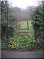
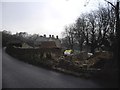
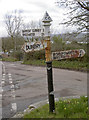
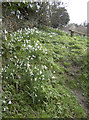
31 photos from this area
Area Information
Key information about the BS41 8JA including its size, population, and administrative classification.
- Area Type
- Postcode
- Area Size
- 4.5 hectares
- Population
- 1812
- Population Density
- 130 people/km²
House Prices in BS41 8JA
16
Properties
£368,308
Average Sold Price
£110,000
Lowest Price
£1,315,000
Highest Price
Showing 16 properties
| Address | Type | Beds | Baths | Last Sale Price | Last Sale Date | |
|---|---|---|---|---|---|---|
| The Ham, Ham Lane, Dundry, BS41 8JA | Detached | 4 | 1 | £1,315,000 | Dec 2021 | |
| Rockwell Cottage, Ham Lane, Dundry, BS41 8JA | house | - | - | £435,000 | Dec 2018 | |
| Yew Tree Cottage, Ham Lane, Dundry, BS41 8JA | Cottage | 2 | 1 | £330,000 | Feb 2018 | |
| Bridge View, Ham Lane, Dundry, BS41 8JA | Detached | 3 | 1 | £350,000 | Mar 2017 | |
| Northern Lights, Ham Lane, Dundry, BS41 8JA | Detached | 3 | 1 | £397,500 | Dec 2015 | |
| Holly Tree Cottage, Ham Lane, Dundry, BS41 8JA | Detached | 3 | - | £235,000 | Jun 2014 | |
| Hillview House, Ham Lane, Dundry, BS41 8JA | Detached | 4 | 1 | £305,000 | May 2014 | |
| Louantha, Ham Lane, Dundry, BS41 8JA | Detached | 3 | 1 | £365,000 | Oct 2013 | |
| Little Orchard, Ham Lane, Dundry, BS41 8JA | house | - | - | £268,500 | Aug 2013 | |
| Harwood House, Ham Lane, Dundry, BS41 8JA | Semi-detached | - | - | £290,000 | Jan 2002 |
Page 1 of 2
Energy Efficiency in BS41 8JA
Amenities
Schools
| Rank | School | Type | Entry gender | Ages |
|---|
Explore more schools in this area
Go to Schools tabDemographics
Household Size
Family (3-5 people)
most common
Accommodation Type
Houses
most common
Tenure
88
majority
Ethnic Group
White
most common
Religion
N/A
most common
Household Composition
N/A
most common
Age
47
median
Adults (30-64 years)
most common
Household Deprivation
N/A
with no deprivation
NS-SEC
42
in Lower managerial occupations
Explore more demographic insights in this area
Go to Demographics tabPlanning
Planning Constraints
- Flood RiskPremium
- Ramsar Wetland SitesPremium
- Area of Outstanding Natural BeautyPremium
- Protected Nature ReservePremium
- Protected WoodlandPremium