Area Overview for BS37 8UN
Photos of BS37 8UN

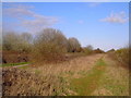
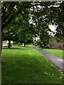
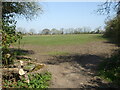
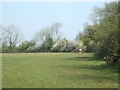

12 photos from this area
Area Information
Key information about the BS37 8UN including its size, population, and administrative classification.
- Area Type
- Postcode
- Area Size
- 7777 m²
- Population
- 1411
- Population Density
- 6754 people/km²
House Prices in BS37 8UN
23
Properties
£205,538
Average Sold Price
£53,000
Lowest Price
£290,000
Highest Price
Showing 23 properties
| Address | Type | Beds | Baths | Last Sale Price | Last Sale Date | |
|---|---|---|---|---|---|---|
| 145 Maisemore, Yate, BS37 8UN | Terraced | 3 | 1 | £276,000 | Mar 2025 | |
| 153 Maisemore, Yate, BS37 8UN | Terraced | 3 | - | £248,000 | Jul 2024 | |
| 147 Maisemore, Yate, BS37 8UN | Terraced | 3 | 1 | £290,000 | Apr 2024 | |
| 139 Maisemore, Yate, BS37 8UN | Terraced | 3 | 1 | £275,000 | Feb 2024 | |
| 156 Maisemore, Yate, BS37 8UN | Terraced | 3 | 1 | £290,000 | Nov 2022 | |
| 144 Maisemore, Yate, BS37 8UN | house | 3 | - | £250,000 | Nov 2021 | |
| 142 Maisemore, Yate, BS37 8UN | Terraced | 3 | 1 | £191,000 | May 2019 | |
| 154 Maisemore, Yate, BS37 8UN | Terraced | 3 | 1 | £185,000 | Nov 2018 | |
| 136 Maisemore, Yate, BS37 8UN | Terraced | 3 | 1 | £199,000 | May 2017 | |
| 141 Maisemore, Yate, BS37 8UN | Terraced | 3 | 1 | £170,000 | Oct 2015 |
Page 1 of 3
Energy Efficiency in BS37 8UN
Amenities
Schools
| Rank | School | Type | Entry gender | Ages |
|---|
Explore more schools in this area
Go to Schools tabDemographics
Household Size
Family (3-5 people)
most common
Accommodation Type
Houses
most common
Tenure
81
majority
Ethnic Group
White
most common
Religion
N/A
most common
Household Composition
N/A
most common
Age
47
median
Adults (30-64 years)
most common
Household Deprivation
N/A
with no deprivation
NS-SEC
24
in Lower managerial occupations
Explore more demographic insights in this area
Go to Demographics tabPlanning
Planning Constraints
- Flood RiskPremium
- Ramsar Wetland SitesPremium
- Area of Outstanding Natural BeautyPremium
- Protected Nature ReservePremium
- Protected WoodlandPremium