Area Overview for BS37 7QL
Photos of BS37 7QL
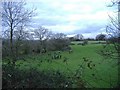
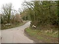
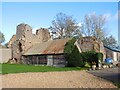
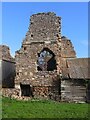
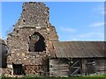
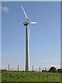
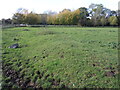
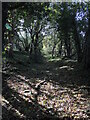
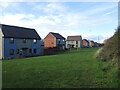
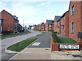
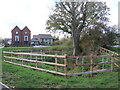
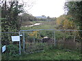
21 photos from this area
Area Information
Key information about the BS37 7QL including its size, population, and administrative classification.
- Area Type
- Postcode
- Area Size
- 55.9 hectares
- Population
- 2085
- Population Density
- 151 people/km²
House Prices in BS37 7QL
14
Properties
£318,500
Average Sold Price
£300,000
Lowest Price
£337,000
Highest Price
Showing 14 properties
| Address | Type | Beds | Baths | Last Sale Price | Last Sale Date | |
|---|---|---|---|---|---|---|
| The Old Dairy, Tanhouse Lane, Yate, BS37 7QL | Semi-detached | 3 | 2 | £337,000 | Nov 2011 | |
| Tanhouse Farm Cottage, Tanhouse Lane, Yate, BS37 7QL | Detached | - | - | £300,000 | Apr 2008 | |
| Leechpool Farm, Tanhouse Lane, Yate, BS37 7QL | house | 1 | 1 | - | - | |
| The Granary Barn, Tanhouse Lane, Yate, BS37 7QL | Farm | 3 | 2 | - | - | |
| Gilliflower, Tanhouse Lane, Yate, BS37 7QL | Semi-detached | - | - | - | - | |
| Swallows Nest, Tanhouse Lane, Yate, BS37 7QL | Semi-detached | 1 | 1 | - | - | |
| Elstar, Tanhouse Lane, Yate, BS37 7QL | hotel | - | - | - | - | |
| Russet, Tanhouse Lane, Yate, BS37 7QL | Semi-detached | - | - | - | - | |
| Caravan Site, Tanhouse Farm, Tanhouse Lane, Yate, BS37 7QL | commercial | - | - | - | - | |
| The Tallet, Tanhouse Lane, Yate, BS37 7QL | house | 1 | 1 | - | - |
Page 1 of 2
Energy Efficiency in BS37 7QL
Amenities
Schools
| Rank | School | Type | Entry gender | Ages |
|---|
Explore more schools in this area
Go to Schools tabDemographics
Household Size
Family (3-5 people)
most common
Accommodation Type
Houses
most common
Tenure
79
majority
Ethnic Group
White
most common
Religion
N/A
most common
Household Composition
N/A
most common
Age
47
median
Adults (30-64 years)
most common
Household Deprivation
N/A
with no deprivation
NS-SEC
46
in Lower managerial occupations
Explore more demographic insights in this area
Go to Demographics tabPlanning
Planning Constraints
- Flood RiskPremium
- Ramsar Wetland SitesPremium
- Area of Outstanding Natural BeautyPremium
- Protected Nature ReservePremium
- Protected WoodlandPremium