Area Overview for BS37 7PX
Photos of BS37 7PX
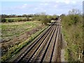
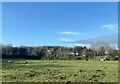
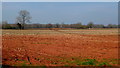
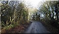
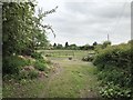

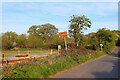
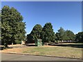
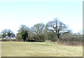
10 photos from this area
Area Information
Key information about the BS37 7PX including its size, population, and administrative classification.
- Area Type
- Postcode
- Area Size
- 25.7 hectares
- Population
- 2262
- Population Density
- 113 people/km²
House Prices in BS37 7PX
26
Properties
£382,925
Average Sold Price
£84,250
Lowest Price
£650,000
Highest Price
Showing 26 properties
| Address | Type | Beds | Baths | Last Sale Price | Last Sale Date | |
|---|---|---|---|---|---|---|
| 19 Engine Common Lane, Yate, BS37 7PX | Detached | 4 | 3 | £650,000 | Jul 2024 | |
| 13 Engine Common Lane, Yate, BS37 7PX | house | - | - | £490,000 | Mar 2024 | |
| 23 Engine Common Lane, Yate, BS37 7PX | house | - | - | £405,000 | Apr 2018 | |
| Conifers, 28 Engine Common Lane, Yate, BS37 7PX | house | - | - | £395,000 | Feb 2012 | |
| Rock View, Engine Common Lane, Yate, BS37 7PX | house | - | - | £350,000 | Oct 2010 | |
| 18 Engine Common Lane, Yate, BS37 7PX | Semi-detached | - | - | £330,000 | Jan 2005 | |
| 10 Engine Common Lane, Yate, BS37 7PX | Detached | 6 | 3 | £580,000 | Aug 2004 | |
| 20 Engine Common Lane, Yate, BS37 7PX | Detached | 5 | 4 | £295,000 | Apr 2000 | |
| Newland House, Engine Common Lane, Yate, BS37 7PX | Detached | - | - | £250,000 | Jan 1996 | |
| 22 Engine Common Lane, Yate, BS37 7PX | Detached | - | - | £84,250 | Aug 1995 |
Page 1 of 3
Energy Efficiency in BS37 7PX
Amenities
Schools
| Rank | School | Type | Entry gender | Ages |
|---|
Explore more schools in this area
Go to Schools tabDemographics
Household Size
Two person
most common
Accommodation Type
Houses
most common
Tenure
80
majority
Ethnic Group
White
most common
Religion
N/A
most common
Household Composition
N/A
most common
Age
47
median
Adults (30-64 years)
most common
Household Deprivation
N/A
with no deprivation
NS-SEC
39
in Lower managerial occupations
Explore more demographic insights in this area
Go to Demographics tabPlanning
Planning Constraints
- Flood RiskPremium
- Ramsar Wetland SitesPremium
- Area of Outstanding Natural BeautyPremium
- Protected Nature ReservePremium
- Protected WoodlandPremium