Area Overview for BS37 7AG
Photos of BS37 7AG
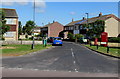
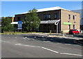
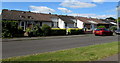
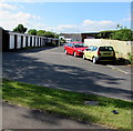
100 photos from this area
Area Information
Key information about the BS37 7AG including its size, population, and administrative classification.
- Area Type
- Postcode
- Area Size
- 9990 m²
- Population
- 1488
- Population Density
- 4063 people/km²
House Prices in BS37 7AG
18
Properties
£219,876
Average Sold Price
£50,000
Lowest Price
£377,000
Highest Price
Showing 18 properties
| Address | Type | Beds | Baths | Last Sale Price | Last Sale Date | |
|---|---|---|---|---|---|---|
| 76 Firgrove Crescent, Yate, BS37 7AG | Semi-detached | 3 | 1 | £377,000 | Mar 2025 | |
| 68 Firgrove Crescent, Yate, BS37 7AG | house | - | - | £325,000 | Jul 2024 | |
| Flat, 84 Firgrove Crescent, Yate, BS37 7AG | Flat | - | - | £320,000 | Mar 2018 | |
| 78 Firgrove Crescent, Yate, BS37 7AG | house | - | - | £190,000 | Jan 2013 | |
| 62 Firgrove Crescent, Yate, BS37 7AG | house | 4 | - | £245,000 | Jan 2012 | |
| 58 Firgrove Crescent, Yate, BS37 7AG | Semi-detached | 5 | 3 | £134,386 | Dec 2009 | |
| 56 Firgrove Crescent, Yate, BS37 7AG | Semi-detached | - | - | £172,500 | Nov 2008 | |
| 60 Firgrove Crescent, Yate, BS37 7AG | Semi-detached | - | - | £165,000 | Apr 2006 | |
| 50 Firgrove Crescent, Yate, BS37 7AG | Semi-detached | - | - | £50,000 | Nov 1997 | |
| 74 Firgrove Crescent, Yate, BS37 7AG | Detached | 3 | - | - | - |
Page 1 of 2
Energy Efficiency in BS37 7AG
Amenities
Schools
| Rank | School | Type | Entry gender | Ages |
|---|
Explore more schools in this area
Go to Schools tabDemographics
Household Size
Two person
most common
Accommodation Type
Houses
most common
Tenure
77
majority
Ethnic Group
White
most common
Religion
N/A
most common
Household Composition
N/A
most common
Age
47
median
Adults (30-64 years)
most common
Household Deprivation
N/A
with no deprivation
NS-SEC
33
in Lower managerial occupations
Explore more demographic insights in this area
Go to Demographics tabPlanning
Planning Constraints
- Flood RiskPremium
- Ramsar Wetland SitesPremium
- Area of Outstanding Natural BeautyPremium
- Protected Nature ReservePremium
- Protected WoodlandPremium