Area Overview for BS37 7AU
Photos of BS37 7AU
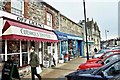
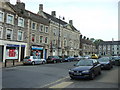
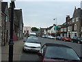
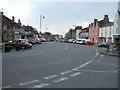
100 photos from this area
Area Information
Key information about the BS37 7AU including its size, population, and administrative classification.
- Area Type
- Postcode
- Area Size
- 2.2 hectares
- Population
- 1488
- Population Density
- 4063 people/km²
House Prices in BS37 7AU
32
Properties
£239,842
Average Sold Price
£66,000
Lowest Price
£440,000
Highest Price
Showing 32 properties
| Address | Type | Beds | Baths | Last Sale Price | Last Sale Date | |
|---|---|---|---|---|---|---|
| 51A Melrose Avenue, Yate, BS37 7AU | Semi-detached | 4 | 3 | £440,000 | Jan 2023 | |
| 37 Melrose Avenue, Yate, BS37 7AU | Semi-detached | 3 | - | £340,000 | Aug 2019 | |
| 29 Melrose Avenue, Yate, BS37 7AU | Detached | 3 | 1 | £285,000 | Nov 2018 | |
| 35 Melrose Avenue, Yate, BS37 7AU | Semi-detached | 3 | - | £305,000 | Oct 2018 | |
| 39 Melrose Avenue, Yate, BS37 7AU | Semi-detached | 3 | - | £260,000 | Nov 2016 | |
| 45 Melrose Avenue, Yate, BS37 7AU | Detached | 3 | 1 | £226,000 | May 2014 | |
| 61 Melrose Avenue, Yate, BS37 7AU | Semi-detached | 5 | - | £290,000 | Apr 2014 | |
| 21 Melrose Avenue, Yate, BS37 7AU | house | - | - | £212,000 | Oct 2011 | |
| 25 Melrose Avenue, Yate, BS37 7AU | house | 3 | - | £215,000 | Dec 2009 | |
| 15 Melrose Avenue, Yate, BS37 7AU | house | - | - | £198,000 | Jan 2005 |
Page 1 of 4
Energy Efficiency in BS37 7AU
Amenities
Schools
| Rank | School | Type | Entry gender | Ages |
|---|
Explore more schools in this area
Go to Schools tabDemographics
Household Size
Two person
most common
Accommodation Type
Houses
most common
Tenure
77
majority
Ethnic Group
White
most common
Religion
N/A
most common
Household Composition
N/A
most common
Age
47
median
Adults (30-64 years)
most common
Household Deprivation
N/A
with no deprivation
NS-SEC
33
in Lower managerial occupations
Explore more demographic insights in this area
Go to Demographics tabPlanning
Planning Constraints
- Flood RiskPremium
- Ramsar Wetland SitesPremium
- Area of Outstanding Natural BeautyPremium
- Protected Nature ReservePremium
- Protected WoodlandPremium