Area Overview for BS34 8PG
Photos of BS34 8PG

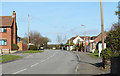
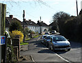
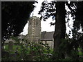
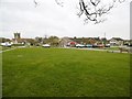

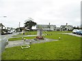
100 photos from this area
Area Information
Key information about the BS34 8PG including its size, population, and administrative classification.
- Area Type
- Postcode
- Area Size
- 1.2 hectares
- Population
- Not available
- Population Density
- Not available
House Prices in BS34 8PG
26
Properties
£270,468
Average Sold Price
£48,000
Lowest Price
£565,000
Highest Price
Showing 26 properties
| Address | Type | Beds | Baths | Last Sale Price | Last Sale Date | |
|---|---|---|---|---|---|---|
| 96 Rock Lane, Stoke Gifford, BS34 8PG | house | - | - | £565,000 | Jun 2021 | |
| 66 Rock Lane, Stoke Gifford, BS34 8PG | Detached | 4 | 2 | £390,000 | Mar 2021 | |
| Vermont, 58 Rock Lane, Stoke Gifford, BS34 8PG | Terraced | 3 | 1 | £280,000 | Mar 2021 | |
| 62 Rock Lane, Stoke Gifford, BS34 8PG | Detached | 4 | 2 | £392,000 | Mar 2021 | |
| 92 Rock Lane, Stoke Gifford, BS34 8PG | house | - | - | £275,000 | Feb 2021 | |
| 90 Rock Lane, Stoke Gifford, BS34 8PG | Terraced | 3 | 1 | £280,000 | Nov 2020 | |
| 68 Rock Lane, Stoke Gifford, BS34 8PG | Detached | 4 | 1 | £340,000 | Sep 2019 | |
| 82 Rock Lane, Stoke Gifford, BS34 8PG | Terraced | 3 | 1 | £254,000 | Aug 2018 | |
| 84 Rock Lane, Stoke Gifford, BS34 8PG | Terraced | 3 | - | £240,500 | Jan 2017 | |
| 50 Rock Lane, Stoke Gifford, BS34 8PG | Terraced | 3 | - | £259,950 | Mar 2016 |
Page 1 of 3
Energy Efficiency in BS34 8PG
Amenities
Schools
| Rank | School | Type | Entry gender | Ages |
|---|
Explore more schools in this area
Go to Schools tabDemographics
Household Size
Family (3-5 people)
most common
Accommodation Type
Houses
most common
Tenure
81
majority
Ethnic Group
White
most common
Religion
N/A
most common
Household Composition
N/A
most common
Age
47
median
Adults (30-64 years)
most common
Household Deprivation
N/A
with no deprivation
NS-SEC
49
in Lower managerial occupations
Explore more demographic insights in this area
Go to Demographics tabPlanning
Planning Constraints
- Flood RiskPremium
- Ramsar Wetland SitesPremium
- Area of Outstanding Natural BeautyPremium
- Protected Nature ReservePremium
- Protected WoodlandPremium