Area Overview for BS34 8PF
Photos of BS34 8PF

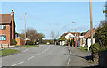
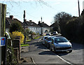
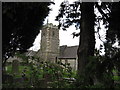
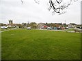

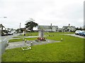


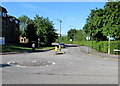
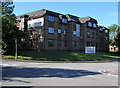
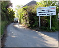
100 photos from this area
Area Information
Key information about the BS34 8PF including its size, population, and administrative classification.
- Area Type
- Postcode
- Area Size
- 2.1 hectares
- Population
- Not available
- Population Density
- Not available
House Prices in BS34 8PF
30
Properties
£361,471
Average Sold Price
£92,000
Lowest Price
£630,000
Highest Price
Showing 30 properties
| Address | Type | Beds | Baths | Last Sale Price | Last Sale Date | |
|---|---|---|---|---|---|---|
| 28 Rock Lane, Stoke Gifford, BS34 8PF | Semi-detached | 4 | 2 | £463,000 | Oct 2024 | |
| 32 Rock Lane, Stoke Gifford, BS34 8PF | Semi-detached | 3 | 1 | £395,000 | Feb 2024 | |
| Grindlewald, 37 Rock Lane, Stoke Gifford, BS34 8PF | Bungalow | 3 | 2 | £630,000 | Nov 2023 | |
| 5A Rock Lane, Stoke Gifford, BS34 8PF | Detached | 4 | 2 | £545,000 | Aug 2023 | |
| Springfield, 18 Rock Lane, Stoke Gifford, BS34 8PF | Semi-detached | 3 | 2 | £435,000 | Mar 2022 | |
| 48 Rock Lane, Stoke Gifford, BS34 8PF | house | - | - | £410,000 | Feb 2021 | |
| 7A Rock Lane, Stoke Gifford, BS34 8PF | Bungalow | 4 | 2 | £425,000 | Jul 2020 | |
| 3 Rock Lane, Stoke Gifford, BS34 8PF | Bungalow | 4 | 1 | £465,000 | Dec 2019 | |
| 19 Rock Lane, Stoke Gifford, BS34 8PF | Semi-detached | 4 | 1 | £375,000 | Nov 2019 | |
| Old Police Station, 38 Rock Lane, Stoke Gifford, BS34 8PF | Detached | 4 | 3 | £515,000 | Jul 2018 |
Page 1 of 3
Energy Efficiency in BS34 8PF
Amenities
Schools
| Rank | School | Type | Entry gender | Ages |
|---|
Explore more schools in this area
Go to Schools tabDemographics
Household Size
Family (3-5 people)
most common
Accommodation Type
Houses
most common
Tenure
81
majority
Ethnic Group
White
most common
Religion
N/A
most common
Household Composition
N/A
most common
Age
47
median
Adults (30-64 years)
most common
Household Deprivation
N/A
with no deprivation
NS-SEC
49
in Lower managerial occupations
Explore more demographic insights in this area
Go to Demographics tabPlanning
Planning Constraints
- Flood RiskPremium
- Ramsar Wetland SitesPremium
- Area of Outstanding Natural BeautyPremium
- Protected Nature ReservePremium
- Protected WoodlandPremium