Area Overview for BS34 7DL
Photos of BS34 7DL


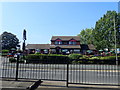
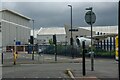
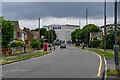
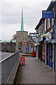
41 photos from this area
Area Information
Key information about the BS34 7DL including its size, population, and administrative classification.
- Area Type
- Postcode
- Area Size
- 6989 m²
- Population
- 1607
- Population Density
- 1238 people/km²
House Prices in BS34 7DL
18
Properties
£221,808
Average Sold Price
£127,000
Lowest Price
£305,000
Highest Price
Showing 18 properties
| Address | Type | Beds | Baths | Last Sale Price | Last Sale Date | |
|---|---|---|---|---|---|---|
| 175 Lower House Crescent, Filton, BS34 7DL | Semi-detached | 3 | 1 | £170,000 | Nov 2022 | |
| 181 Lower House Crescent, Filton, BS34 7DL | Terraced | 4 | 2 | £300,000 | Sep 2022 | |
| 183 Lower House Crescent, Filton, BS34 7DL | house | - | - | £305,000 | Mar 2022 | |
| 102 Lower House Crescent, Filton, BS34 7DL | Terraced | 3 | 1 | £300,000 | Nov 2021 | |
| 108 Lower House Crescent, Filton, BS34 7DL | Terraced | 3 | 1 | £255,000 | Apr 2019 | |
| 104 Lower House Crescent, Filton, BS34 7DL | Terraced | 6 | 2 | £228,500 | Jul 2018 | |
| 177 Lower House Crescent, Filton, BS34 7DL | Semi-detached | 3 | - | £208,000 | Apr 2017 | |
| 106 Lower House Crescent, Filton, BS34 7DL | Terraced | 3 | - | £215,000 | Jul 2016 | |
| 114 Lower House Crescent, Filton, BS34 7DL | Terraced | 3 | 1 | £200,000 | Mar 2016 | |
| 110 Lower House Crescent, Filton, BS34 7DL | Terraced | 3 | 1 | £200,000 | Aug 2015 |
Page 1 of 2
Energy Efficiency in BS34 7DL
Amenities
Schools
| Rank | School | Type | Entry gender | Ages |
|---|
Explore more schools in this area
Go to Schools tabDemographics
Household Size
Family (3-5 people)
most common
Accommodation Type
Houses
most common
Tenure
56
majority
Ethnic Group
White
most common
Religion
N/A
most common
Household Composition
N/A
most common
Age
47
median
Adults (30-64 years)
most common
Household Deprivation
N/A
with no deprivation
NS-SEC
30
in Lower managerial occupations
Explore more demographic insights in this area
Go to Demographics tabPlanning
Planning Constraints
- Flood RiskPremium
- Ramsar Wetland SitesPremium
- Area of Outstanding Natural BeautyPremium
- Protected Nature ReservePremium
- Protected WoodlandPremium