Area Overview for BS34 7AS
Photos of BS34 7AS

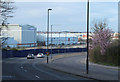
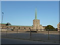
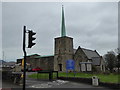

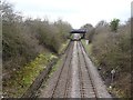
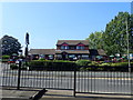
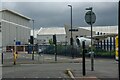
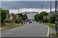
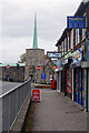
41 photos from this area
Area Information
Key information about the BS34 7AS including its size, population, and administrative classification.
- Area Type
- Postcode
- Area Size
- 6714 m²
- Population
- 1607
- Population Density
- 1238 people/km²
House Prices in BS34 7AS
18
Properties
£148,315
Average Sold Price
£45,950
Lowest Price
£320,000
Highest Price
Showing 18 properties
| Address | Type | Beds | Baths | Last Sale Price | Last Sale Date | |
|---|---|---|---|---|---|---|
| 848 Filton Avenue, Filton, BS34 7AS | Terraced | 5 | 2 | £320,000 | Oct 2021 | |
| 854 Filton Avenue, Filton, BS34 7AS | Terraced | 4 | 2 | £234,400 | May 2021 | |
| 850 Filton Avenue, Filton, BS34 7AS | Terraced | 4 | 2 | £176,500 | Jun 2014 | |
| 840 Filton Avenue, Filton, BS34 7AS | house | - | - | £159,500 | Aug 2013 | |
| 846 Filton Avenue, Filton, BS34 7AS | Semi-detached | - | - | £199,995 | Jan 2007 | |
| 844 Filton Avenue, Filton, BS34 7AS | Semi-detached | - | - | £150,000 | Sep 2004 | |
| 872 Filton Avenue, Filton, BS34 7AS | Terraced | 5 | 1 | £75,300 | Jul 2000 | |
| 870 Filton Avenue, Filton, BS34 7AS | Terraced | - | - | £61,500 | Oct 1999 | |
| 842 Filton Avenue, Filton, BS34 7AS | Semi-detached | 5 | 2 | £60,000 | Dec 1998 | |
| 852 Filton Avenue, Filton, BS34 7AS | Terraced | - | - | £45,950 | Jan 1998 |
Page 1 of 2
Energy Efficiency in BS34 7AS
Amenities
Schools
| Rank | School | Type | Entry gender | Ages |
|---|
Explore more schools in this area
Go to Schools tabDemographics
Household Size
Family (3-5 people)
most common
Accommodation Type
Houses
most common
Tenure
56
majority
Ethnic Group
White
most common
Religion
N/A
most common
Household Composition
N/A
most common
Age
47
median
Adults (30-64 years)
most common
Household Deprivation
N/A
with no deprivation
NS-SEC
30
in Lower managerial occupations
Explore more demographic insights in this area
Go to Demographics tabPlanning
Planning Constraints
- Flood RiskPremium
- Ramsar Wetland SitesPremium
- Area of Outstanding Natural BeautyPremium
- Protected Nature ReservePremium
- Protected WoodlandPremium