Area Overview for BS32 4JH
Photos of BS32 4JH

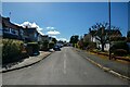
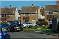
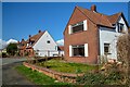

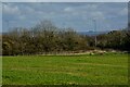
37 photos from this area
Area Information
Key information about the BS32 4JH including its size, population, and administrative classification.
- Area Type
- Postcode
- Area Size
- 34.6 hectares
- Population
- 2938
- Population Density
- 346 people/km²
House Prices in BS32 4JH
27
Properties
£435,643
Average Sold Price
£95,000
Lowest Price
£710,000
Highest Price
Showing 27 properties
| Address | Type | Beds | Baths | Last Sale Price | Last Sale Date | |
|---|---|---|---|---|---|---|
| Cope Cottage, 6 Hortham Lane, Almondsbury, BS32 4JH | Detached | 5 | - | £573,000 | Sep 2024 | |
| Chatsworth, 7 Hortham Lane, Almondsbury, BS32 4JH | Detached | 4 | 2 | £710,000 | Jul 2024 | |
| 25 Hortham Lane, Almondsbury, BS32 4JH | Retail | 3 | 1 | £412,500 | Mar 2022 | |
| The Firs, 19A Hortham Lane, Almondsbury, BS32 4JH | Detached | 3 | 2 | £451,000 | Jun 2021 | |
| 15 Hortham Lane, Almondsbury, BS32 4JH | Detached | 5 | 3 | £642,500 | Jun 2020 | |
| 8 Hortham Lane, Almondsbury, BS32 4JH | Detached | 5 | - | £665,000 | Dec 2016 | |
| 4 Hortham Lane, Almondsbury, BS32 4JH | Detached | 4 | - | £485,000 | Nov 2014 | |
| 15A Hortham Lane, Almondsbury, BS32 4JH | Detached | 4 | 2 | £485,000 | Nov 2014 | |
| Standale, 21 Hortham Lane, Almondsbury, BS32 4JH | Bungalow | - | - | £445,000 | Jul 2013 | |
| Underhill, 19 Hortham Lane, Almondsbury, BS32 4JH | Bungalow | 3 | - | £372,500 | Mar 2010 |
Page 1 of 3
Energy Efficiency in BS32 4JH
Amenities
Schools
| Rank | School | Type | Entry gender | Ages |
|---|
Explore more schools in this area
Go to Schools tabDemographics
Household Size
Family (3-5 people)
most common
Accommodation Type
Houses
most common
Tenure
81
majority
Ethnic Group
White
most common
Religion
N/A
most common
Household Composition
N/A
most common
Age
47
median
Adults (30-64 years)
most common
Household Deprivation
N/A
with no deprivation
NS-SEC
48
in Lower managerial occupations
Explore more demographic insights in this area
Go to Demographics tabPlanning
Planning Constraints
- Flood RiskPremium
- Ramsar Wetland SitesPremium
- Area of Outstanding Natural BeautyPremium
- Protected Nature ReservePremium
- Protected WoodlandPremium