Area Overview for BS32 4HW
Photos of BS32 4HW
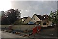
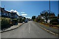
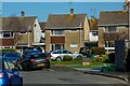
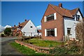
37 photos from this area
Area Information
Key information about the BS32 4HW including its size, population, and administrative classification.
- Area Type
- Postcode
- Area Size
- 6.5 hectares
- Population
- 1888
- Population Density
- 104 people/km²
House Prices in BS32 4HW
9
Properties
£484,750
Average Sold Price
£340,000
Lowest Price
£800,000
Highest Price
Showing 9 properties
| Address | Type | Beds | Baths | Last Sale Price | Last Sale Date | |
|---|---|---|---|---|---|---|
| Woodhouse Farm, 65 Gloucester Road, Almondsbury, BS32 4HW | Cottage | 3 | 2 | £800,000 | Sep 2022 | |
| Ridgemead, 61 Gloucester Road, Almondsbury, BS32 4HW | Detached | 5 | 2 | £420,000 | Mar 2018 | |
| Woodhouse Farm Cottage, 67 Gloucester Road, Almondsbury, BS32 4HW | Land | - | - | £340,000 | Sep 2009 | |
| Windyridge, 63 Gloucester Road, Almondsbury, BS32 4HW | house | - | - | £379,000 | Jul 2006 | |
| Rose Lea, 69 Gloucester Road, Almondsbury, BS32 4HW | Detached | - | - | - | - | |
| Cottage View, 1B Gloucester Road, Almondsbury, BS32 4HW | Mobile Home | - | - | - | - | |
| Cottage View, 1A Gloucester Road, Almondsbury, BS32 4HW | Mobile Home | - | - | - | - | |
| The Byre, 67A Gloucester Road, Almondsbury, BS32 4HW | Detached | - | - | - | - | |
| 63A Gloucester Road, Almondsbury, BS32 4HW | Semi-detached | - | - | - | - |
Energy Efficiency in BS32 4HW
Amenities
Schools
| Rank | School | Type | Entry gender | Ages |
|---|
Explore more schools in this area
Go to Schools tabDemographics
Household Size
Two person
most common
Accommodation Type
Houses
most common
Tenure
86
majority
Ethnic Group
White
most common
Religion
N/A
most common
Household Composition
N/A
most common
Age
47
median
Adults (30-64 years)
most common
Household Deprivation
N/A
with no deprivation
NS-SEC
52
in Lower managerial occupations
Explore more demographic insights in this area
Go to Demographics tabPlanning
Planning Constraints
- Flood RiskPremium
- Ramsar Wetland SitesPremium
- Area of Outstanding Natural BeautyPremium
- Protected Nature ReservePremium
- Protected WoodlandPremium