Area Overview for BS30 6NG
Photos of BS30 6NG
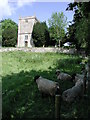
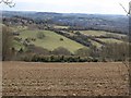

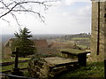
49 photos from this area
Area Information
Key information about the BS30 6NG including its size, population, and administrative classification.
- Area Type
- Postcode
- Area Size
- 96.1 hectares
- Population
- 2167
- Population Density
- 195 people/km²
House Prices in BS30 6NG
10
Properties
£1,062,500
Average Sold Price
£925,000
Lowest Price
£1,200,000
Highest Price
Showing 10 properties
| Address | Type | Beds | Baths | Last Sale Price | Last Sale Date | |
|---|---|---|---|---|---|---|
| Pipley View, North Stoke Lane, Upton Cheyney, BS30 6NG | house | 4 | - | £925,000 | Feb 2017 | |
| Pipley Old Farm, North Stoke Lane, Upton Cheyney, BS30 6NG | Detached | - | - | £1,200,000 | Jul 2014 | |
| Pipley Court Farmhouse, North Stoke Lane, Upton Cheyney, BS30 6NG | Detached | 3 | 2 | - | - | |
| Pipley Bottom Farm, North Stoke Lane, Upton Cheyney, BS30 6NG | Detached | - | - | - | - | |
| Congrove Cottage, North Stoke Lane, Upton Cheyney, BS30 6NG | Land | 2 | - | - | - | |
| Congrove Stables, North Stoke Lane, Upton Cheyney, BS30 6NG | Farm | 4 | 3 | - | - | |
| The Lodge, Pipley Court Farm, North Stoke Lane, Upton Cheyney, BS30 6NG | hotel | - | - | - | - | |
| Brockham House, North Stoke Lane, Upton Cheyney, BS30 6NG | house | - | - | - | - | |
| The Studio, Congrove Cottage, North Stoke Lane, Upton Cheyney, BS30 6NG | Detached | - | - | - | - | |
| Mobile Home, Pipley Court Farm, North Stoke Lane, Upton Cheyney, BS30 6NG | Mobile Home | - | - | - | - |
Energy Efficiency in BS30 6NG
Amenities
Schools
| Rank | School | Type | Entry gender | Ages |
|---|
Explore more schools in this area
Go to Schools tabDemographics
Household Size
Two person
most common
Accommodation Type
Houses
most common
Tenure
71
majority
Ethnic Group
White
most common
Religion
N/A
most common
Household Composition
N/A
most common
Age
47
median
Adults (30-64 years)
most common
Household Deprivation
N/A
with no deprivation
NS-SEC
41
in Lower managerial occupations
Explore more demographic insights in this area
Go to Demographics tabPlanning
Planning Constraints
- Flood RiskPremium
- Ramsar Wetland SitesPremium
- Area of Outstanding Natural BeautyPremium
- Protected Nature ReservePremium
- Protected WoodlandPremium