Area Overview for BS30 5QZ
Photos of BS30 5QZ


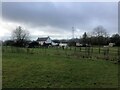

9 photos from this area
Area Information
Key information about the BS30 5QZ including its size, population, and administrative classification.
- Area Type
- Postcode
- Area Size
- 57.0 hectares
- Population
- 1239
- Population Density
- 722 people/km²
House Prices in BS30 5QZ
17
Properties
£390,000
Average Sold Price
£44,000
Lowest Price
£588,500
Highest Price
Showing 17 properties
| Address | Type | Beds | Baths | Last Sale Price | Last Sale Date | |
|---|---|---|---|---|---|---|
| ABSON TRS, RIDING BARN HILL, Wick, BS30 5QZ | Detached | - | - | £44,000 | Oct 2023 | |
| The Homestead, 93 Riding Barn Hill, Wick, BS30 5QZ | Detached | 6 | 1 | £588,500 | Nov 2018 | |
| 71 Riding Barn Hill, Wick, BS30 5QZ | Bungalow | 4 | - | £425,000 | Mar 2016 | |
| Holmoaks, Riding Barn Hill, Wick, BS30 5QZ | house | 4 | - | £499,999 | Sep 2011 | |
| Highfield Park House, Riding Barn Hill, Wick, BS30 5QZ | Terraced | - | - | £392,500 | May 2002 | |
| Highfield House, 112 Riding Barn Hill, Wick, BS30 5QZ | Detached | 5 | 2 | - | - | |
| The Coach House, Riding Barn Hill, Wick, BS30 5QZ | Semi-detached | 4 | - | - | - | |
| The Barn, Riding Barn Hill, Wick, BS30 5QZ | Terraced | - | - | - | - | |
| Highfield Barn, Riding Barn Hill, Wick, BS30 5QZ | house | 6 | - | - | - | |
| Highfield Park Farm, Riding Barn Hill, Wick, BS30 5QZ | Terraced | - | - | - | - |
Page 1 of 2
Energy Efficiency in BS30 5QZ
Amenities
Schools
| Rank | School | Type | Entry gender | Ages |
|---|
Explore more schools in this area
Go to Schools tabDemographics
Household Size
Two person
most common
Accommodation Type
Houses
most common
Tenure
80
majority
Ethnic Group
White
most common
Religion
N/A
most common
Household Composition
N/A
most common
Age
47
median
Adults (30-64 years)
most common
Household Deprivation
N/A
with no deprivation
NS-SEC
38
in Lower managerial occupations
Explore more demographic insights in this area
Go to Demographics tabPlanning
Planning Constraints
- Flood RiskPremium
- Ramsar Wetland SitesPremium
- Area of Outstanding Natural BeautyPremium
- Protected Nature ReservePremium
- Protected WoodlandPremium