Area Overview for BS3 2EQ
Photos of BS3 2EQ


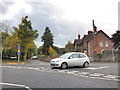


100 photos from this area
Area Information
Key information about the BS3 2EQ including its size, population, and administrative classification.
- Area Type
- Postcode
- Area Size
- 1.2 hectares
- Population
- 2083
- Population Density
- 1892 people/km²
House Prices in BS3 2EQ
53
Properties
£339,432
Average Sold Price
£33,950
Lowest Price
£640,000
Highest Price
Showing 53 properties
| Address | Type | Beds | Baths | Last Sale Price | Last Sale Date | |
|---|---|---|---|---|---|---|
| 59 Ashton Road, Ashton, Bristol, BS3 2EQ | house | 4 | 1 | £640,000 | Jul 2022 | |
| 35 Ashton Road, Ashton, Bristol, BS3 2EQ | Terraced | 4 | 2 | £470,000 | Feb 2022 | |
| 55 Ashton Road, Ashton, Bristol, BS3 2EQ | Terraced | 4 | - | £500,000 | Sep 2021 | |
| 51 Ashton Road, Ashton, Bristol, BS3 2EQ | house | 5 | - | £485,000 | Mar 2021 | |
| 64 Ashton Road, Ashton, Bristol, BS3 2EQ | Terraced | 4 | 2 | £500,000 | Dec 2019 | |
| 57 Ashton Road, Ashton, Bristol, BS3 2EQ | Terraced | 3 | 1 | £465,000 | Aug 2019 | |
| 44 Ashton Road, Ashton, Bristol, BS3 2EQ | Terraced | 4 | 1 | £395,000 | May 2019 | |
| 63 Ashton Road, Ashton, Bristol, BS3 2EQ | house | - | - | £447,500 | Sep 2018 | |
| 38 Ashton Road, Ashton, Bristol, BS3 2EQ | Terraced | 1 | - | £470,000 | Aug 2018 | |
| 39 Ashton Road, Ashton, Bristol, BS3 2EQ | Terraced | 3 | - | £415,000 | Jan 2018 |
Page 1 of 6
Energy Efficiency in BS3 2EQ
Amenities
Schools
| Rank | School | Type | Entry gender | Ages |
|---|
Explore more schools in this area
Go to Schools tabDemographics
Household Size
One person
most common
Accommodation Type
Flats
most common
Tenure
42
majority
Ethnic Group
White
most common
Religion
N/A
most common
Household Composition
N/A
most common
Age
47
median
Adults (30-64 years)
most common
Household Deprivation
N/A
with no deprivation
NS-SEC
42
in Lower managerial occupations
Explore more demographic insights in this area
Go to Demographics tabPlanning
Planning Constraints
- Flood RiskPremium
- Ramsar Wetland SitesPremium
- Area of Outstanding Natural BeautyPremium
- Protected Nature ReservePremium
- Protected WoodlandPremium