Area Overview for BS3 2BH
Photos of BS3 2BH


Area Information
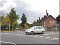
BS3 2BH is a small residential postcode area in Bristol, England, encompassing a tightly knit cluster of homes. With a population of 2,083 and a density of 1,892 people per square kilometre, it reflects a compact, urbanised community. Historically part of Somerset, the area has roots in Roman and medieval times, with streets like East Street and West Street tracing back to ancient origins. Today, it is a mature neighbourhood where the average age is 47, dominated by adults aged 30–64. Daily life here balances proximity to the city’s amenities with a sense of local identity. The area is served by multiple rail stations, including Parson Street and Bedminster, and is within reach of Bristol Airport. Its mix of retail options, from supermarkets to co-ops, and its connection to the River Avon via the New Cut, offer both practicality and a touch of historical charm. For those seeking a blend of convenience and tradition, BS3 2BH provides a distinct slice of Bristol’s evolving character.
- Area Type
- Postcode
- Area Size
- Not available
- Population
- 2083
- Population Density
- 1892 people/km²
The property market in BS3 2BH is characterised by a 42% home ownership rate, meaning that nearly 60% of residents rent their homes. This suggests a rental-dominated market, which is common in urban areas with limited housing stock. The predominant accommodation type is flats, aligning with the area’s density and compact layout. Given the postcode’s small size, the housing options are likely limited to a few blocks of flats or converted buildings. For buyers, this presents challenges: the market is not driven by owner-occupation, and the availability of properties for sale may be constrained. However, the proximity to rail stations and the city’s amenities could make it appealing to investors or those seeking rental income. Prospective buyers should consider the area’s small footprint and the potential for competition in a limited housing supply.
House Prices in BS3 2BH
No properties found in this postcode.
Energy Efficiency in BS3 2BH
The lifestyle in BS3 2BH is shaped by its proximity to a range of amenities. Retail options include Iceland South Bristol Retail, Aldi Southville, and The Southern Co-operative Co, providing access to groceries and daily essentials. The five ferry landings, such as Nova Scotia Ferry Landing, may offer leisure opportunities or alternative transport routes. Rail stations like Clifton Down and Parson Street connect residents to broader networks, while the nearby airports cater to travel needs. Though the area lacks large parks or leisure hubs, its compact size ensures that amenities are within walking or short-vehicle distance. The mix of retail, transport, and connectivity options supports a convenient, urban lifestyle, blending practicality with the city’s vibrancy.
Amenities
Schools
Residents of BS3 2BH have access to several primary schools, including Ashton Gate Primary School and Ashton Park School, the latter of which operates as an academy with a ‘good’ Ofsted rating. The presence of two primary schools provides families with options for early education, though secondary school choices may require commuting to nearby areas. The academy’s ‘good’ rating indicates a school with strong performance in key metrics such as pupil outcomes and staff quality. However, the absence of secondary schools within the immediate area means that families must plan for longer journeys to secondary education. The mix of traditional and academy schools reflects a balance between established institutions and modern educational models, offering a range of approaches to learning.
| Rank | School | Type | Entry gender | Ages |
|---|
Explore more schools in this area
Go to Schools tabDemographics
The community in BS3 2BH is predominantly composed of adults aged 30–64, with a median age of 47. This suggests a mature population, likely with established careers and families. Home ownership rates here are 42%, lower than the national average, indicating a significant proportion of residents rent their homes. The primary accommodation type is flats, reflecting a trend towards urban living in this compact area. The predominant ethnic group is White, though specific diversity metrics are not provided. The absence of detailed data on deprivation or socioeconomic status means that quality of life factors such as access to services and infrastructure must be inferred from available amenities. The age profile and housing stock suggest a stable, long-term resident base, though the lower home ownership rate may imply a transient element.
Household Size
Accommodation Type
Tenure
Ethnic Group
Religion
Household Composition
Age
Household Deprivation
NS-SEC
Explore more demographic insights in this area
Go to Demographics tabPlanning
Planning Constraints
- Flood RiskPremium
- Ramsar Wetland SitesPremium
- Area of Outstanding Natural BeautyPremium
- Protected Nature ReservePremium
- Protected WoodlandPremium