Area Overview for BS26 2XG
Photos of BS26 2XG
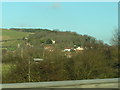

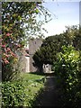
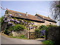
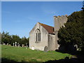
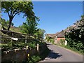


65 photos from this area
Area Information
Key information about the BS26 2XG including its size, population, and administrative classification.
- Area Type
- Postcode
- Area Size
- 6.5 hectares
- Population
- 1465
- Population Density
- 127 people/km²
House Prices in BS26 2XG
19
Properties
£414,636
Average Sold Price
£297,950
Lowest Price
£600,000
Highest Price
Showing 19 properties
| Address | Type | Beds | Baths | Last Sale Price | Last Sale Date | |
|---|---|---|---|---|---|---|
| The Bow, Christon Road, Loxton, BS26 2XG | Detached | 5 | 2 | £600,000 | Mar 2021 | |
| Pump Cottages, 10 Christon Road, Loxton, BS26 2XG | house | - | - | £413,500 | Mar 2021 | |
| Christon Cottage, Christon Road, Loxton, BS26 2XG | house | - | - | £415,000 | Sep 2019 | |
| Court Farm House, Christon Road, Loxton, BS26 2XG | Bungalow | 2 | - | £484,000 | Jul 2016 | |
| Penns, Christon Road, Loxton, BS26 2XG | Detached | 3 | - | £330,000 | Sep 2014 | |
| Walnut Tree House, Christon Road, Loxton, BS26 2XG | house | 5 | 2 | £362,000 | Jun 2014 | |
| The Old Barn, Christon Road, Loxton, BS26 2XG | Semi-detached | 3 | - | £297,950 | Mar 2003 | |
| The Old Granary, Christon Road, Loxton, BS26 2XG | Semi-detached | 4 | 2 | - | - | |
| West Wing, Old Rectory, Christon Road, Loxton, BS26 2XG | Flat | - | - | - | - | |
| The Gables, Old Rectory, Christon Road, Loxton, BS26 2XG | Detached | - | - | - | - |
Page 1 of 2
Energy Efficiency in BS26 2XG
Amenities
Schools
| Rank | School | Type | Entry gender | Ages |
|---|
Explore more schools in this area
Go to Schools tabDemographics
Household Size
Two person
most common
Accommodation Type
Houses
most common
Tenure
88
majority
Ethnic Group
White
most common
Religion
N/A
most common
Household Composition
N/A
most common
Age
47
median
Adults (30-64 years)
most common
Household Deprivation
N/A
with no deprivation
NS-SEC
34
in Lower managerial occupations
Explore more demographic insights in this area
Go to Demographics tabPlanning
Planning Constraints
- Flood RiskPremium
- Ramsar Wetland SitesPremium
- Area of Outstanding Natural BeautyPremium
- Protected Nature ReservePremium
- Protected WoodlandPremium