Area Overview for BS26 2RS
Photos of BS26 2RS
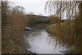


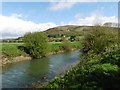
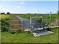


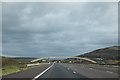
21 photos from this area
Area Information
Key information about the BS26 2RS including its size, population, and administrative classification.
- Area Type
- Postcode
- Area Size
- 1.8 km²
- Population
- 2328
- Population Density
- 96 people/km²
House Prices in BS26 2RS
11
Properties
£481,573
Average Sold Price
£165,000
Lowest Price
£1,075,000
Highest Price
Showing 11 properties
| Address | Type | Beds | Baths | Last Sale Price | Last Sale Date | |
|---|---|---|---|---|---|---|
| Crab Hole Farm, Biddisham Lane, Biddisham, Axbridge, BS26 2RS | Detached | - | - | £250,000 | Aug 2025 | |
| Tile House Farm, Biddisham Lane, Biddisham, Axbridge, BS26 2RS | Detached | 4 | 3 | £1,075,000 | Sep 2023 | |
| Waterfront Farm, Biddisham Lane, Biddisham, Axbridge, BS26 2RS | house | - | - | £500,000 | Jun 2021 | |
| River Cottage, Biddisham Lane, Biddisham, Axbridge, BS26 2RS | Semi-detached | - | - | £445,000 | Aug 2020 | |
| Chestnut Farm, Biddisham Lane, Biddisham, Axbridge, BS26 2RS | house | - | - | £454,436 | Dec 2016 | |
| Meadowside Lodge, Biddisham Lane, Biddisham, Axbridge, BS26 2RS | Semi-detached | - | - | £165,000 | Feb 2005 | |
| Kingsacre, Biddisham Lane, Biddisham, Axbridge, BS26 2RS | Bungalow | - | - | - | - | |
| Poplar Farm, Biddisham Lane, Biddisham, Axbridge, BS26 2RS | Terraced | - | - | - | - | |
| Riverside Farm, Biddisham Lane, Biddisham, Axbridge, BS26 2RS | house | 4 | - | - | - | |
| Waterfront Cottages, Biddisham Lane, Biddisham, Axbridge, BS26 2RS | Semi-detached | - | - | - | - |
Page 1 of 2
Energy Efficiency in BS26 2RS
Amenities
Schools
| Rank | School | Type | Entry gender | Ages |
|---|
Explore more schools in this area
Go to Schools tabDemographics
Household Size
Two person
most common
Accommodation Type
Houses
most common
Tenure
81
majority
Ethnic Group
White
most common
Religion
N/A
most common
Household Composition
N/A
most common
Age
47
median
Adults (30-64 years)
most common
Household Deprivation
N/A
with no deprivation
NS-SEC
37
in Lower managerial occupations
Explore more demographic insights in this area
Go to Demographics tabPlanning
Planning Constraints
- Flood RiskPremium
- Ramsar Wetland SitesPremium
- Area of Outstanding Natural BeautyPremium
- Protected Nature ReservePremium
- Protected WoodlandPremium