Area Overview for BS26 2BA
Photos of BS26 2BA


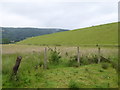


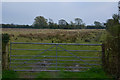

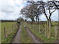
32 photos from this area
Area Information
Key information about the BS26 2BA including its size, population, and administrative classification.
- Area Type
- Postcode
- Area Size
- 45.3 hectares
- Population
- 1999
- Population Density
- 421 people/km²
House Prices in BS26 2BA
47
Properties
£277,094
Average Sold Price
£5,000
Lowest Price
£640,000
Highest Price
Showing 47 properties
| Address | Type | Beds | Baths | Last Sale Price | Last Sale Date | |
|---|---|---|---|---|---|---|
| Walnut Farm, Portmeade Drove, Axbridge, BS26 2BA | Land | - | - | £5,000 | May 2025 | |
| Barn Cottage, Moorland Street, Axbridge, BS26 2BA | house | 4 | - | £250,000 | Mar 2025 | |
| Charter Court, Moorland Street, Axbridge, BS26 2BA | Flat | 1 | 1 | £640,000 | Jan 2024 | |
| 24 Moorland Street, Axbridge, BS26 2BA | house | - | - | £150,000 | Oct 2023 | |
| May Cottage, Moorland Street, Axbridge, BS26 2BA | house | 2 | 1 | £340,000 | Jan 2023 | |
| The Old Forge Barn, Moorland Street, Axbridge, BS26 2BA | house | 2 | 1 | £371,500 | Jul 2022 | |
| Merrybrook, Portmeade Drove, Axbridge, BS26 2BA | house | - | - | £420,000 | Jul 2022 | |
| 2 Portmeade Drove, Axbridge, BS26 2BA | Detached | - | - | £400,000 | Jun 2021 | |
| The Crooked Cottage, Moorland Street, Axbridge, BS26 2BA | Cottage | 3 | 1 | £375,000 | Aug 2020 | |
| Stable Cottage, Moorland Street, Axbridge, BS26 2BA | Cottage | 4 | 2 | £380,000 | May 2016 |
Page 1 of 5
Energy Efficiency in BS26 2BA
Amenities
Schools
| Rank | School | Type | Entry gender | Ages |
|---|
Explore more schools in this area
Go to Schools tabDemographics
Household Size
One person
most common
Accommodation Type
Houses
most common
Tenure
71
majority
Ethnic Group
White
most common
Religion
N/A
most common
Household Composition
N/A
most common
Age
47
median
Adults (30-64 years)
most common
Household Deprivation
N/A
with no deprivation
NS-SEC
39
in Lower managerial occupations
Explore more demographic insights in this area
Go to Demographics tabPlanning
Planning Constraints
- Flood RiskPremium
- Ramsar Wetland SitesPremium
- Area of Outstanding Natural BeautyPremium
- Protected Nature ReservePremium
- Protected WoodlandPremium