Area Overview for BS24 6RT
Photos of BS24 6RT
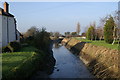
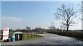
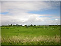
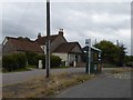
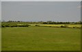
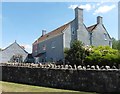
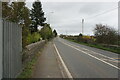
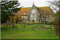
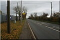
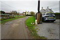
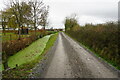
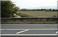
36 photos from this area
Area Information
Key information about the BS24 6RT including its size, population, and administrative classification.
- Area Type
- Postcode
- Area Size
- 10.6 hectares
- Population
- 1767
- Population Density
- 123 people/km²
House Prices in BS24 6RT
17
Properties
£430,488
Average Sold Price
£276,950
Lowest Price
£555,000
Highest Price
Showing 17 properties
| Address | Type | Beds | Baths | Last Sale Price | Last Sale Date | |
|---|---|---|---|---|---|---|
| The Coach House, Bristol Road, Hewish, BS24 6RT | Detached | 4 | 3 | £390,000 | Jun 2021 | |
| Watermans, Bristol Road, Hewish, BS24 6RT | Detached | 4 | - | £500,000 | Dec 2016 | |
| 2, St Annes Lodge, Bristol Road, Hewish, BS24 6RT | retail_financial | - | - | £555,000 | Apr 2010 | |
| Grange Cottage, Bristol Road, Hewish, BS24 6RT | Semi-detached | - | - | £276,950 | Sep 2007 | |
| Watermans Bow, Bristol Road, Hewish, BS24 6RT | Detached | 4 | 2 | - | - | |
| Watermans Keep, Bristol Road, Hewish, BS24 6RT | Detached | - | - | - | - | |
| Teneriffe, Bristol Road, Hewish, BS24 6RT | Bungalow | - | - | - | - | |
| Full Quart, Bristol Road, Hewish, BS24 6RT | Bungalow | - | - | - | - | |
| L Ancresse, Bristol Road, Hewish, BS24 6RT | Bungalow | - | - | - | - | |
| L Ancresse Annexe, Bristol Road, Hewish, BS24 6RT | Bungalow | - | - | - | - |
Page 1 of 2
Energy Efficiency in BS24 6RT
Amenities
Schools
| Rank | School | Type | Entry gender | Ages |
|---|
Explore more schools in this area
Go to Schools tabDemographics
Household Size
Family (3-5 people)
most common
Accommodation Type
Houses
most common
Tenure
79
majority
Ethnic Group
White
most common
Religion
N/A
most common
Household Composition
N/A
most common
Age
47
median
Adults (30-64 years)
most common
Household Deprivation
N/A
with no deprivation
NS-SEC
39
in Lower managerial occupations
Explore more demographic insights in this area
Go to Demographics tabPlanning
Planning Constraints
- Flood RiskPremium
- Ramsar Wetland SitesPremium
- Area of Outstanding Natural BeautyPremium
- Protected Nature ReservePremium
- Protected WoodlandPremium