Area Overview for BS20 8EP
Photos of BS20 8EP
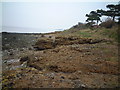
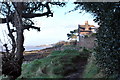
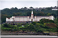
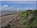

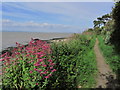
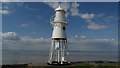
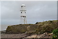
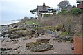
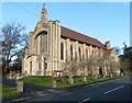
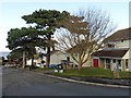
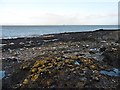
59 photos from this area
Area Information
Key information about the BS20 8EP including its size, population, and administrative classification.
- Area Type
- Postcode
- Area Size
- 1.8 hectares
- Population
- 1363
- Population Density
- 1786 people/km²
House Prices in BS20 8EP
19
Properties
£359,750
Average Sold Price
£86,500
Lowest Price
£725,000
Highest Price
Showing 19 properties
| Address | Type | Beds | Baths | Last Sale Price | Last Sale Date | |
|---|---|---|---|---|---|---|
| 6 Beechwood Road, Portishead, BS20 8EP | Retail | 3 | 2 | £502,500 | Apr 2022 | |
| 28 Beechwood Road, Portishead, BS20 8EP | house | - | - | £600,000 | Dec 2021 | |
| 22 Beechwood Road, Portishead, BS20 8EP | house | - | - | £575,000 | Jun 2021 | |
| 34 Beechwood Road, Portishead, BS20 8EP | Detached | 4 | - | £725,000 | Aug 2017 | |
| 30 Beechwood Road, Portishead, BS20 8EP | Bungalow | 3 | 1 | £367,000 | Jan 2016 | |
| 18 Beechwood Road, Portishead, BS20 8EP | Bungalow | - | - | £359,000 | Nov 2015 | |
| 2 Beechwood Road, Portishead, BS20 8EP | Bungalow | - | - | £250,000 | Apr 2012 | |
| 14 Beechwood Road, Portishead, BS20 8EP | Bungalow | - | - | £310,000 | Nov 2011 | |
| 16 Beechwood Road, Portishead, BS20 8EP | Detached | - | - | £280,000 | Oct 2009 | |
| 24 Beechwood Road, Portishead, BS20 8EP | house | - | - | £365,500 | Jul 2007 |
Page 1 of 2
Energy Efficiency in BS20 8EP
Amenities
Schools
| Rank | School | Type | Entry gender | Ages |
|---|
Explore more schools in this area
Go to Schools tabDemographics
Household Size
Two person
most common
Accommodation Type
Houses
most common
Tenure
87
majority
Ethnic Group
White
most common
Religion
N/A
most common
Household Composition
N/A
most common
Age
47
median
Adults (30-64 years)
most common
Household Deprivation
N/A
with no deprivation
NS-SEC
52
in Lower managerial occupations
Explore more demographic insights in this area
Go to Demographics tabPlanning
Planning Constraints
- Flood RiskPremium
- Ramsar Wetland SitesPremium
- Area of Outstanding Natural BeautyPremium
- Protected Nature ReservePremium
- Protected WoodlandPremium