Area Overview for BS20 6BY
Photos of BS20 6BY

Area Information
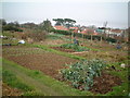
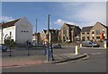
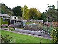
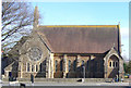
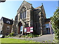
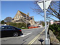
Living in BS20 6BY offers a distinct experience within a small residential cluster that covers just 813 square metres. This postcode area forms part of the wider Portishead civil parish in North Somerset, situated near the Bristol Channel approximately ten miles west of Bristol. The population stands at 1,310 residents across this compact footprint, creating a character where daily life moves at a considered pace away from the noise of larger urban centres. You are entering a settled environment rooted in history, where the land was first mentioned in the Domesday Book of 1086 as 'Porteshe' and later developed around docks and seaside resorts in the nineteenth century. Residents enjoy a setting defined by its coastal heritage, featuring landmarks such as the 12th-century St. Peter's Church and the Battery Point Lighthouse built in 1931. The area has evolved from its fishing port origins into a suburb with Victorian-era High Street development and a former dock now serving as a marina. While the rail network had closed to passengers by 1964, the location remains anchored by its geographical position between Church Road North and South, offering sheltered topography that defines the local atmosphere. For those seeking homes in BS20 6BY, you are choosing a site with deep historical layers, from Iron Age settlements to the Industrial Revolution, now resting within a quiet, established residential zone.
- Area Type
- Postcode
- Area Size
- 813 m²
- Population
- 1310
- Population Density
- 3204 people/km²
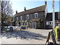
The property market in BS20 6BY reflects a mature, owner-occupied community rather than a transient rental zone. With a home ownership percentage standing at 75 per cent, the majority of residents are owners rather than tenants. This high level of ownership creates a stable market where properties are often held for the long term, reducing the typical turnover seen in areas dominated by private landlords or student housing. Accommodation types consist almost exclusively of houses, which aligns with the area's designation as a residential cluster within Portishead. For buyers looking at this small area, this market structure means prices tend to reflect the value of freehold assets rather than rental yields. You will find a stock of houses that cater to established households, likely including the Victorian and post-industrial developments mentioned in historical records. The fact that the property area covers only 813 square metres while housing 1,310 people suggests a mix of detached and semi-detached homes rather than high-rise apartments. There is no significant presence of flats in this postcode, so your search for homes in BS20 6BY will focus entirely on the single-family market. This environment suits buyers seeking the security of ownership in a settled town with deep historical roots and minimal uncertainty regarding future developments or market volatility.
House Prices in BS20 6BY
Showing 5 properties
| Address | Type | Beds | Baths | Last Sale Price | Last Sale Date | |
|---|---|---|---|---|---|---|
| 4 Rose Mews, Portishead, BS20 6BY | Semi-detached | 2 | 2 | £356,000 | Oct 2023 | |
| 5 Rose Mews, Portishead, BS20 6BY | Detached | 2 | 1 | £325,000 | Dec 2020 | |
| 2 Rose Mews, Portishead, BS20 6BY | Semi-detached | 2 | 2 | £329,950 | Mar 2019 | |
| 3 Rose Mews, Portishead, BS20 6BY | Semi-detached | 3 | 1 | £295,000 | May 2017 | |
| 1 Rose Mews, Portishead, BS20 6BY | Semi-detached | 2 | 1 | £318,000 | Nov 2016 |
Energy Efficiency in BS20 6BY
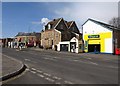
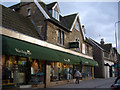
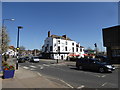
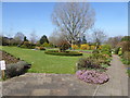
Daily life in BS20 6BY benefits from a diverse range of amenities within practical reach, enhancing convenience for residents. Retail options include five nearby stores, with notable names such as Aldi Portishead, Iceland Portishead, and Waitrose Portishead providing everyday shopping. Three ferry services offer leisure opportunities, connecting you to Portishead Pier, Bristol Docks Ferry Landing, and Clevedon Pier for coastal exploration. Five railway stations including Avonmouth Railway Station and Portway Park & Ride Railway Station provide additional transit choices for commuting or day trips. You gain access to historic landmarks like the 12th-century St. Peter's Church and the Lake Grounds, which opened in 1910 and offer recreational space. The vicinity to the Bristol Channel provides a backdrop for quiet walks along sheltered topography between Church Road North and South. The former dock now converted into Portishead Marina adds a scenic element to the local character, blending industrial heritage with modern leisure. For families and individuals alike, the presence of supermarkets, ferry terminals, and rail stations means you do not need to travel far for essentials or entertainment. The area combines historic charm with functional infrastructure, creating a balanced lifestyle where coastal heritage meets modern convenience.
Amenities
Schools
Families residing near BS20 6BY have access to the Quayside Education Centre, which is located in close proximity to the postcode. This institution operates as a special school, catering to specific educational needs within the local area. As a single special school, the immediate vicinity does not offer a wide variety of mainstream primary or secondary options for general education. Parents considering schools near BS20 6BY must account for the nature of this facility, which provides inclusive education for children requiring specialist support. The presence of only one nearby school indicates that families may need to travel further for mainstream education options outside the immediate neighbourhood. The special nature of the Quayside Education Centre means it serves a unique function, distinguishing itself from standard primary or secondary schools found in larger urban areas. For residents prioritising educational variety, this limited selection necessitates looking beyond the immediate doorstep for additional schooling choices. However, for those whose needs align with the provisions of the Quayside Education Centre, you have a dedicated educational facility close to your home. This school type reflects the community's commitment to inclusive education alongside other local amenities and services.
| Rank | School | Type | Entry gender | Ages |
|---|
Explore more schools in this area
Go to Schools tabDemographics
The community in BS20 6BY is defined by an older demographic structure, with a median age of 47 years. The most common age range comprises adults between 30 and 64 years old, indicating a population past the initial raising stages of young families or with young families raising older children. This maturity is reflected in the high home ownership level of 75 per cent, which suggests long-term settlement and financial stability among residents. Accommodation types consist primarily of houses rather than flats, aligning with the character of a suburban coastal town rather than a high-density urban block. The predominant ethnic group in this postcode area is White, contributing to a community with established local roots. You will find a neighbourhood where people have deep ties to the location, often described affectionately as 'Posset' by those familiar with the region's history. The low rate of renting or mobility points to a stable environment where residents typically stay put for significant periods. This demographic profile means you are looking at an area where established lifestyles dominate, with a strong presence of homeowners who have likely lived in the district for decades. The age distribution and housing tenure reinforce the quiet, settled nature of life in this specific cluster of Portishead.
Household Size
Accommodation Type
Tenure
Ethnic Group
Religion
Household Composition
Age
Household Deprivation
NS-SEC
Explore more demographic insights in this area
Go to Demographics tabPlanning
Planning Constraints
- Flood RiskPremium
- Ramsar Wetland SitesPremium
- Area of Outstanding Natural BeautyPremium
- Protected Nature ReservePremium
- Protected WoodlandPremium