Area Overview for BS20 6BL
Photos of BS20 6BL

Area Information
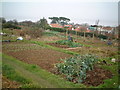
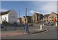
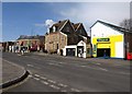
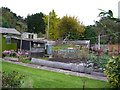
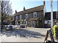
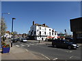
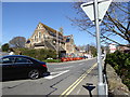
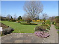
BS20 6BL is a small, tightly knit residential postcode area in North Somerset, encompassing parts of the coastal town of Portishead. With a population of 1,310 spread across 377 square metres, it is densely populated yet retains a distinct character rooted in its history as a fishing port and seaside resort. The area’s compact size means residents are close to the Bristol Channel, with easy access to the marina and Lake Grounds, a public park opened in 1910. Portishead’s origins date back to the Domesday Book, and its layout reflects centuries of development around docks, rail lines, and the High Street. Today, it blends historic architecture with modern amenities, serving as a commuter hub for nearby Bristol, just 10 miles east. The area’s charm lies in its proximity to nature, transport links, and a mix of retail and leisure options, making it appealing to those seeking a balance between coastal living and urban connectivity.
- Area Type
- Postcode
- Area Size
- 377 m²
- Population
- 1310
- Population Density
- 3204 people/km²
BS20 6BL is primarily an owner-occupied area, with 75% of homes owned by residents rather than rented. The accommodation type is predominantly houses, which is unusual for a small postcode area but aligns with Portishead’s historical development as a suburban and coastal town. This suggests a mix of older, traditional homes and post-industrial housing stock, likely reflecting the area’s transition from a working-port community to a residential one. The limited size of the postcode means the housing market is small, with limited options for buyers, though proximity to Bristol and nearby transport links may attract commuters. For those seeking a house, the area offers a blend of characterful properties and practical living, though the high population density (3.5 million per square kilometre) indicates limited space for expansion or new builds.
House Prices in BS20 6BL
Showing 1 properties
| Address | Type | Beds | Baths | Last Sale Price | Last Sale Date | |
|---|---|---|---|---|---|---|
| Natwest, 25 High Street, Portishead, BS20 6BL | Retail | - | - | - | - |
Energy Efficiency in BS20 6BL
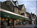
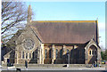
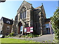
Living in BS20 6BL offers a blend of practicality and coastal charm. The area’s retail options include Iceland, Aldi, and Waitrose, providing grocery and household needs. For leisure, residents can access Portishead Pier, Clevedon Pier, and the Portishead Marina, which was once a deep-water dock. The Lake Grounds, a public park opened in 1910, offers recreational space, while nearby rail stations like Avonmouth and St Andrews Road connect to Bristol’s transport network. The area’s historical sites, such as St. Peter’s Church and Court House Farm, add cultural depth. However, the absence of detailed data on dining or entertainment options means the full range of lifestyle amenities remains partially unexplored. Nonetheless, the proximity to water, green spaces, and transport links suggests a balanced lifestyle for residents.
Amenities
Schools
The only school explicitly listed near BS20 6BL is Quayside Education Centre, a special school. This suggests the area may not have a comprehensive range of educational options for all age groups, though nearby towns like Portishead and Bristol likely offer additional schools. The presence of a special school indicates the area may cater to families with children requiring specialist education, but it does not provide information on the quality of schooling or Ofsted ratings. For families seeking a broader range of schools, including primary and secondary options, they would need to look beyond BS20 6BL itself, potentially commuting to nearby towns or schools within the broader Portishead or Bristol areas.
| Rank | School | Type | Entry gender | Ages |
|---|
Explore more schools in this area
Go to Schools tabDemographics
The population of BS20 6BL is predominantly middle-aged, with a median age of 47 and the most common age range being adults aged 30–64. This suggests a community of established residents, many of whom may be long-term homeowners. Home ownership is high, at 75%, with the majority of properties being houses rather than flats or apartments. The predominant ethnic group is White, reflecting the area’s historical and cultural continuity. The high proportion of homeowners indicates a stable, long-term resident base, though the absence of specific data on deprivation or income levels means the area’s economic diversity remains unquantified. The age profile suggests a mature demographic, potentially with fewer young families, though this is not explicitly confirmed by the data.
Household Size
Accommodation Type
Tenure
Ethnic Group
Religion
Household Composition
Age
Household Deprivation
NS-SEC
Explore more demographic insights in this area
Go to Demographics tabPlanning
Planning Constraints
- Flood RiskPremium
- Ramsar Wetland SitesPremium
- Area of Outstanding Natural BeautyPremium
- Protected Nature ReservePremium
- Protected WoodlandPremium