Area Overview for BS16 1WF
Photos of BS16 1WF
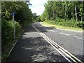
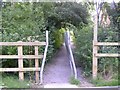
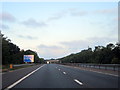


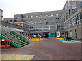
42 photos from this area
Area Information
Key information about the BS16 1WF including its size, population, and administrative classification.
- Area Type
- Postcode
- Area Size
- 6945 m²
- Population
- 1295
- Population Density
- 2937 people/km²
House Prices in BS16 1WF
41
Properties
£190,805
Average Sold Price
£96,950
Lowest Price
£400,000
Highest Price
Showing 41 properties
| Address | Type | Beds | Baths | Last Sale Price | Last Sale Date | |
|---|---|---|---|---|---|---|
| 7 Paxton, Stoke Gifford, BS16 1WF | Flat | 2 | 1 | £250,000 | Aug 2025 | |
| 25 Paxton, Stoke Gifford, BS16 1WF | Detached | 2 | 1 | £240,000 | Jun 2024 | |
| 12 Paxton, Stoke Gifford, BS16 1WF | Terraced | 3 | 1 | £350,000 | May 2024 | |
| 21 Paxton, Stoke Gifford, BS16 1WF | Terraced | 2 | 2 | £300,000 | Sep 2023 | |
| 27 Paxton, Stoke Gifford, BS16 1WF | Detached | 2 | 1 | £245,000 | Oct 2022 | |
| 14 Paxton, Stoke Gifford, BS16 1WF | Flat | - | - | £200,000 | Oct 2021 | |
| 42 Paxton, Stoke Gifford, BS16 1WF | Terraced | 3 | 1 | £208,250 | Sep 2021 | |
| 32 Paxton, Stoke Gifford, BS16 1WF | house | 3 | 2 | £400,000 | Jun 2021 | |
| 40 Paxton, Stoke Gifford, BS16 1WF | Terraced | 3 | 1 | £287,000 | Mar 2021 | |
| 11 Paxton, Stoke Gifford, BS16 1WF | Semi-detached | 2 | 1 | £257,000 | Feb 2021 |
Page 1 of 5
Energy Efficiency in BS16 1WF
Amenities
Schools
| Rank | School | Type | Entry gender | Ages |
|---|
Explore more schools in this area
Go to Schools tabDemographics
Household Size
Family (3-5 people)
most common
Accommodation Type
Houses
most common
Tenure
44
majority
Ethnic Group
White
most common
Religion
N/A
most common
Household Composition
N/A
most common
Age
22
median
Young Adults (15-29 years)
most common
Household Deprivation
N/A
with no deprivation
NS-SEC
38
in Lower managerial occupations
Explore more demographic insights in this area
Go to Demographics tabPlanning
Planning Constraints
- Flood RiskPremium
- Ramsar Wetland SitesPremium
- Area of Outstanding Natural BeautyPremium
- Protected Nature ReservePremium
- Protected WoodlandPremium