Area Overview for BS16 1WA
Photos of BS16 1WA
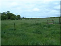
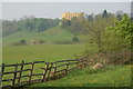
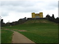
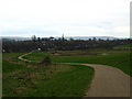


42 photos from this area
Area Information
Key information about the BS16 1WA including its size, population, and administrative classification.
- Area Type
- Postcode
- Area Size
- 3.8 hectares
- Population
- 1295
- Population Density
- 2937 people/km²
House Prices in BS16 1WA
69
Properties
£212,715
Average Sold Price
£89,995
Lowest Price
£439,000
Highest Price
Showing 69 properties
| Address | Type | Beds | Baths | Last Sale Price | Last Sale Date | |
|---|---|---|---|---|---|---|
| 55 Parnell Road, Stoke Gifford, BS16 1WA | Terraced | 2 | 2 | £315,000 | Aug 2023 | |
| 66 Parnell Road, Stoke Gifford, BS16 1WA | Terraced | 3 | 1 | £305,500 | Aug 2023 | |
| 12 Parnell Road, Stoke Gifford, BS16 1WA | house | 2 | 1 | £300,000 | Oct 2022 | |
| 16 Parnell Road, Stoke Gifford, BS16 1WA | Terraced | 2 | 1 | £310,000 | Jul 2022 | |
| 25 Parnell Road, Stoke Gifford, BS16 1WA | house | 4 | 3 | £439,000 | Feb 2022 | |
| 10 Parnell Road, Stoke Gifford, BS16 1WA | Terraced | 4 | 2 | £295,000 | Feb 2022 | |
| 4 Parnell Road, Stoke Gifford, BS16 1WA | Flat | - | - | £220,000 | Aug 2021 | |
| 26 Parnell Road, Stoke Gifford, BS16 1WA | Semi-detached | 4 | 4 | £380,000 | Jun 2021 | |
| 37 Parnell Road, Stoke Gifford, BS16 1WA | Terraced | 3 | 1 | £343,000 | Jun 2021 | |
| 15 Parnell Road, Stoke Gifford, BS16 1WA | Terraced | 2 | 1 | £257,000 | Apr 2021 |
Page 1 of 7
Energy Efficiency in BS16 1WA
Amenities
Schools
| Rank | School | Type | Entry gender | Ages |
|---|
Explore more schools in this area
Go to Schools tabDemographics
Household Size
Family (3-5 people)
most common
Accommodation Type
Houses
most common
Tenure
44
majority
Ethnic Group
White
most common
Religion
N/A
most common
Household Composition
N/A
most common
Age
22
median
Young Adults (15-29 years)
most common
Household Deprivation
N/A
with no deprivation
NS-SEC
38
in Lower managerial occupations
Explore more demographic insights in this area
Go to Demographics tabPlanning
Planning Constraints
- Flood RiskPremium
- Ramsar Wetland SitesPremium
- Area of Outstanding Natural BeautyPremium
- Protected Nature ReservePremium
- Protected WoodlandPremium