Area Overview for BS15 9SQ
Photos of BS15 9SQ
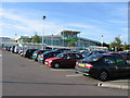
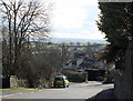
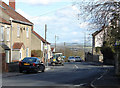
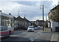

33 photos from this area
Area Information
Key information about the BS15 9SQ including its size, population, and administrative classification.
- Area Type
- Postcode
- Area Size
- 3.9 hectares
- Population
- Not available
- Population Density
- Not available
House Prices in BS15 9SQ
32
Properties
£262,257
Average Sold Price
£55,000
Lowest Price
£581,000
Highest Price
Showing 32 properties
| Address | Type | Beds | Baths | Last Sale Price | Last Sale Date | |
|---|---|---|---|---|---|---|
| 48 Cock Road, Kingswood, BS15 9SQ | Semi-detached | 3 | 2 | £425,000 | Mar 2023 | |
| 51 Cock Road, Kingswood, BS15 9SQ | Retail | 4 | 1 | £379,950 | Oct 2022 | |
| 66 Cock Road, Kingswood, BS15 9SQ | Detached | 5 | - | £581,000 | Jul 2022 | |
| 63 Cock Road, Kingswood, BS15 9SQ | Retail | 3 | 1 | £343,000 | May 2022 | |
| 55 Cock Road, Kingswood, BS15 9SQ | Semi-detached | 3 | 1 | £339,950 | Feb 2022 | |
| 61 Cock Road, Kingswood, BS15 9SQ | Terraced | 3 | 1 | £270,000 | Jul 2021 | |
| 64 Cock Road, Kingswood, BS15 9SQ | Bungalow | - | - | £475,000 | Jun 2021 | |
| 57 Cock Road, Kingswood, BS15 9SQ | house | - | - | £315,000 | Dec 2020 | |
| 45 Cock Road, Kingswood, BS15 9SQ | Terraced | 3 | - | £242,000 | Aug 2020 | |
| 65 Cock Road, Kingswood, BS15 9SQ | house | - | - | £150,000 | Apr 2019 |
Page 1 of 4
Energy Efficiency in BS15 9SQ
Amenities
Schools
| Rank | School | Type | Entry gender | Ages |
|---|
Explore more schools in this area
Go to Schools tabDemographics
Household Size
Two person
most common
Accommodation Type
Houses
most common
Tenure
75
majority
Ethnic Group
White
most common
Religion
N/A
most common
Household Composition
N/A
most common
Age
47
median
Adults (30-64 years)
most common
Household Deprivation
N/A
with no deprivation
NS-SEC
30
in Lower managerial occupations
Explore more demographic insights in this area
Go to Demographics tabPlanning
Planning Constraints
- Flood RiskPremium
- Ramsar Wetland SitesPremium
- Area of Outstanding Natural BeautyPremium
- Protected Nature ReservePremium
- Protected WoodlandPremium