Area Overview for BS14 8SW
Photos of BS14 8SW
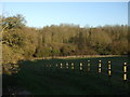
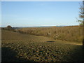
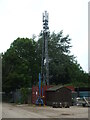
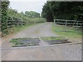
18 photos from this area
Area Information
Key information about the BS14 8SW including its size, population, and administrative classification.
- Area Type
- Postcode
- Area Size
- 7527 m²
- Population
- 1624
- Population Density
- 4671 people/km²
House Prices in BS14 8SW
21
Properties
£194,800
Average Sold Price
£86,000
Lowest Price
£330,000
Highest Price
Showing 21 properties
| Address | Type | Beds | Baths | Last Sale Price | Last Sale Date | |
|---|---|---|---|---|---|---|
| 13 Battson Road, Stockwood, Bristol, BS14 8SW | Semi-detached | 3 | 1 | £330,000 | Sep 2022 | |
| 31 Battson Road, Stockwood, Bristol, BS14 8SW | house | - | - | £261,000 | Dec 2020 | |
| 11 Battson Road, Stockwood, Bristol, BS14 8SW | Semi-detached | 3 | 1 | £284,000 | Sep 2018 | |
| 23 Battson Road, Stockwood, Bristol, BS14 8SW | Semi-detached | 3 | 1 | £195,000 | Mar 2015 | |
| 29 Battson Road, Stockwood, Bristol, BS14 8SW | house | - | - | £160,000 | Aug 2010 | |
| 17 Battson Road, Stockwood, Bristol, BS14 8SW | Semi-detached | - | - | £217,000 | Jan 2008 | |
| 37 Battson Road, Stockwood, Bristol, BS14 8SW | Semi-detached | - | - | £165,000 | Mar 2006 | |
| 1 Battson Road, Stockwood, Bristol, BS14 8SW | house | - | - | £128,000 | Oct 2003 | |
| 39 Battson Road, Stockwood, Bristol, BS14 8SW | Semi-detached | - | - | £122,000 | Jul 2001 | |
| 27 Battson Road, Stockwood, Bristol, BS14 8SW | Semi-detached | - | - | £86,000 | Dec 2000 |
Page 1 of 3
Energy Efficiency in BS14 8SW
Amenities
Schools
| Rank | School | Type | Entry gender | Ages |
|---|
Explore more schools in this area
Go to Schools tabDemographics
Household Size
Family (3-5 people)
most common
Accommodation Type
Houses
most common
Tenure
81
majority
Ethnic Group
White
most common
Religion
N/A
most common
Household Composition
N/A
most common
Age
47
median
Adults (30-64 years)
most common
Household Deprivation
N/A
with no deprivation
NS-SEC
25
in Lower managerial occupations
Explore more demographic insights in this area
Go to Demographics tabPlanning
Planning Constraints
- Flood RiskPremium
- Ramsar Wetland SitesPremium
- Area of Outstanding Natural BeautyPremium
- Protected Nature ReservePremium
- Protected WoodlandPremium