Area Overview for BS11 9QS
Photos of BS11 9QS
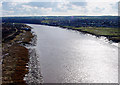
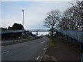
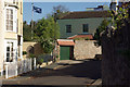
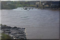
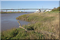
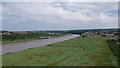
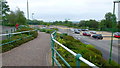
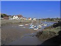
100 photos from this area
Area Information
Key information about the BS11 9QS including its size, population, and administrative classification.
- Area Type
- Postcode
- Area Size
- 1.2 hectares
- Population
- 1597
- Population Density
- 5961 people/km²
House Prices in BS11 9QS
31
Properties
£195,000
Average Sold Price
£110,000
Lowest Price
£365,000
Highest Price
Showing 31 properties
| Address | Type | Beds | Baths | Last Sale Price | Last Sale Date | |
|---|---|---|---|---|---|---|
| 75 Grove Leaze, Shirehampton, Bristol, BS11 9QS | house | - | - | £295,000 | Mar 2025 | |
| 96 Grove Leaze, Shirehampton, Bristol, BS11 9QS | Semi-detached | 3 | 1 | £365,000 | Dec 2024 | |
| 102 Grove Leaze, Shirehampton, Bristol, BS11 9QS | house | - | - | £257,500 | Nov 2021 | |
| 107 Grove Leaze, Shirehampton, Bristol, BS11 9QS | Semi-detached | 3 | 1 | £250,000 | Sep 2018 | |
| 88 Grove Leaze, Shirehampton, Bristol, BS11 9QS | house | - | - | £285,000 | Jul 2018 | |
| 104 Grove Leaze, Shirehampton, Bristol, BS11 9QS | Semi-detached | 3 | - | £175,000 | Mar 2016 | |
| 91 Grove Leaze, Shirehampton, Bristol, BS11 9QS | house | 3 | 1 | £182,000 | Jun 2015 | |
| 89 Grove Leaze, Shirehampton, Bristol, BS11 9QS | Semi-detached | 3 | - | £150,000 | Mar 2014 | |
| 105 Grove Leaze, Shirehampton, Bristol, BS11 9QS | Semi-detached | 3 | 2 | £128,000 | Feb 2012 | |
| 106 Grove Leaze, Shirehampton, Bristol, BS11 9QS | house | 3 | - | £147,500 | Nov 2011 |
Page 1 of 4
Energy Efficiency in BS11 9QS
Amenities
Schools
| Rank | School | Type | Entry gender | Ages |
|---|
Explore more schools in this area
Go to Schools tabDemographics
Household Size
Family (3-5 people)
most common
Accommodation Type
Houses
most common
Tenure
58
majority
Ethnic Group
White
most common
Religion
N/A
most common
Household Composition
N/A
most common
Age
47
median
Adults (30-64 years)
most common
Household Deprivation
N/A
with no deprivation
NS-SEC
24
in Lower managerial occupations
Explore more demographic insights in this area
Go to Demographics tabPlanning
Planning Constraints
- Flood RiskPremium
- Ramsar Wetland SitesPremium
- Area of Outstanding Natural BeautyPremium
- Protected Nature ReservePremium
- Protected WoodlandPremium