Area Overview for BS10 6JU
Photos of BS10 6JU
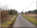
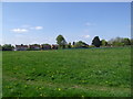
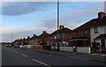
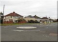
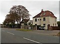
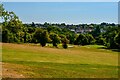
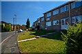

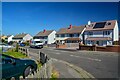
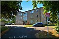
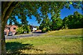
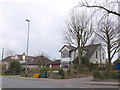
24 photos from this area
Area Information
Key information about the BS10 6JU including its size, population, and administrative classification.
- Area Type
- Postcode
- Area Size
- 3693 m²
- Population
- 1402
- Population Density
- 1838 people/km²
House Prices in BS10 6JU
22
Properties
£129,983
Average Sold Price
£12,000
Lowest Price
£216,000
Highest Price
Showing 22 properties
| Address | Type | Beds | Baths | Last Sale Price | Last Sale Date | |
|---|---|---|---|---|---|---|
| 264 Charlton Road, Brentry, Bristol, BS10 6JU | Flat | 2 | 1 | £216,000 | Oct 2025 | |
| 286A Charlton Road, Brentry, Bristol, BS10 6JU | Flat | - | - | £42,500 | May 2022 | |
| 270 Charlton Road, Brentry, Bristol, BS10 6JU | Flat | - | - | £184,950 | Nov 2021 | |
| 278 Charlton Road, Brentry, Bristol, BS10 6JU | Flat | - | - | £185,000 | Jun 2020 | |
| 284A Charlton Road, Brentry, Bristol, BS10 6JU | Maisonette | - | - | £115,000 | May 2019 | |
| 290A Charlton Road, Brentry, Bristol, BS10 6JU | Flat | - | - | £205,000 | Apr 2018 | |
| Flat, Pen Park Service Station, Charlton Road, Brentry, Bristol, BS10 6JU | Maisonette | 3 | 1 | £27,318 | Sep 2017 | |
| 296 Charlton Road, Brentry, Bristol, BS10 6JU | Flat | - | - | £142,000 | Jun 2015 | |
| 276 Charlton Road, Brentry, Bristol, BS10 6JU | Flat | - | - | £122,000 | Feb 2014 | |
| 262 Charlton Road, Brentry, Bristol, BS10 6JU | house | - | - | £178,000 | Jul 2011 |
Page 1 of 3
Energy Efficiency in BS10 6JU
Amenities
Schools
| Rank | School | Type | Entry gender | Ages |
|---|
Explore more schools in this area
Go to Schools tabDemographics
Household Size
One person
most common
Accommodation Type
Houses
most common
Tenure
80
majority
Ethnic Group
White
most common
Religion
N/A
most common
Household Composition
N/A
most common
Age
47
median
Adults (30-64 years)
most common
Household Deprivation
N/A
with no deprivation
NS-SEC
36
in Lower managerial occupations
Explore more demographic insights in this area
Go to Demographics tabPlanning
Planning Constraints
- Flood RiskPremium
- Ramsar Wetland SitesPremium
- Area of Outstanding Natural BeautyPremium
- Protected Nature ReservePremium
- Protected WoodlandPremium