Area Overview for BH9 3AL
Photos of BH9 3AL
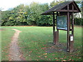
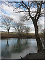
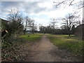
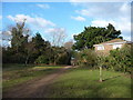

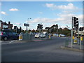
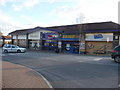
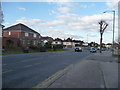
100 photos from this area
Area Information
Key information about the BH9 3AL including its size, population, and administrative classification.
- Area Type
- Postcode
- Area Size
- 5668 m²
- Population
- Not available
- Population Density
- Not available
House Prices in BH9 3AL
21
Properties
£288,892
Average Sold Price
£91,000
Lowest Price
£495,000
Highest Price
Showing 21 properties
| Address | Type | Beds | Baths | Last Sale Price | Last Sale Date | |
|---|---|---|---|---|---|---|
| 17 Redbreast Road, Bournemouth, BH9 3AL | house | - | - | £325,000 | Aug 2025 | |
| 15 Redbreast Road, Bournemouth, BH9 3AL | Detached | 3 | 1 | £365,000 | Feb 2024 | |
| 43 Redbreast Road, Bournemouth, BH9 3AL | house | - | - | £495,000 | Aug 2022 | |
| 29 Redbreast Road, Bournemouth, BH9 3AL | Detached | 3 | 1 | £310,000 | Mar 2021 | |
| 49 Redbreast Road, Bournemouth, BH9 3AL | Detached | 3 | - | £390,000 | Feb 2021 | |
| 27 Redbreast Road, Bournemouth, BH9 3AL | house | - | - | £345,000 | Jan 2021 | |
| 25 Redbreast Road, Bournemouth, BH9 3AL | Detached | 3 | 1 | £340,000 | Jul 2020 | |
| 11 Redbreast Road, Bournemouth, BH9 3AL | house | - | - | £297,000 | May 2020 | |
| 37 Redbreast Road, Bournemouth, BH9 3AL | Detached | 3 | 1 | £335,000 | Jul 2017 | |
| 33 Redbreast Road, Bournemouth, BH9 3AL | Detached | 3 | 1 | £263,500 | Dec 2015 |
Page 1 of 3
Energy Efficiency in BH9 3AL
Amenities
Schools
| Rank | School | Type | Entry gender | Ages |
|---|
Explore more schools in this area
Go to Schools tabDemographics
Household Size
Family (3-5 people)
most common
Accommodation Type
Houses
most common
Tenure
81
majority
Ethnic Group
White
most common
Religion
N/A
most common
Household Composition
N/A
most common
Age
47
median
Adults (30-64 years)
most common
Household Deprivation
N/A
with no deprivation
NS-SEC
37
in Lower managerial occupations
Explore more demographic insights in this area
Go to Demographics tabPlanning
Planning Constraints
- Flood RiskPremium
- Ramsar Wetland SitesPremium
- Area of Outstanding Natural BeautyPremium
- Protected Nature ReservePremium
- Protected WoodlandPremium