Area Overview for BH6 3SQ
Photos of BH6 3SQ
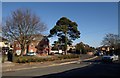
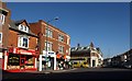
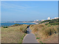
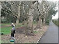
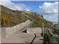
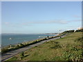
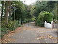
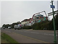
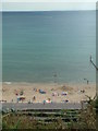
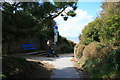
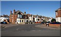
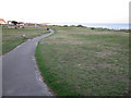
100 photos from this area
Area Information
Key information about the BH6 3SQ including its size, population, and administrative classification.
- Area Type
- Postcode
- Area Size
- 4607 m²
- Population
- 1622
- Population Density
- 7908 people/km²
House Prices in BH6 3SQ
44
Properties
£415,150
Average Sold Price
£148,000
Lowest Price
£710,000
Highest Price
Showing 44 properties
| Address | Type | Beds | Baths | Last Sale Price | Last Sale Date | |
|---|---|---|---|---|---|---|
| 17 Fishermans Avenue, Bournemouth, BH6 3SQ | Terraced | 6 | 3 | £650,000 | Mar 2025 | |
| 9 Fishermans Avenue, Bournemouth, BH6 3SQ | house | - | - | £710,000 | Dec 2021 | |
| 11 Fishermans Avenue, Bournemouth, BH6 3SQ | house | 5 | 3 | £650,000 | Aug 2018 | |
| 5 Fishermans Avenue, Bournemouth, BH6 3SQ | Terraced | 6 | - | £415,000 | Nov 2015 | |
| 12 Fishermans Avenue, Bournemouth, BH6 3SQ | Unknown | - | - | £635,000 | Mar 2015 | |
| 13 Fishermans Avenue, Bournemouth, BH6 3SQ | house | 7 | - | £335,000 | May 2012 | |
| 3 Fishermans Avenue, Bournemouth, BH6 3SQ | Unknown | - | - | £241,000 | Jul 2002 | |
| 8 Fishermans Avenue, Bournemouth, BH6 3SQ | house | - | - | £190,000 | Jul 2001 | |
| 6 Fishermans Avenue, Bournemouth, BH6 3SQ | house | - | - | £177,500 | Apr 2001 | |
| 7 Fishermans Avenue, Bournemouth, BH6 3SQ | house | - | - | £148,000 | Sep 1999 |
Page 1 of 5
Energy Efficiency in BH6 3SQ
Amenities
Schools
| Rank | School | Type | Entry gender | Ages |
|---|
Explore more schools in this area
Go to Schools tabDemographics
Household Size
One person
most common
Accommodation Type
Flats
most common
Tenure
46
majority
Ethnic Group
White
most common
Religion
N/A
most common
Household Composition
N/A
most common
Age
47
median
Adults (30-64 years)
most common
Household Deprivation
N/A
with no deprivation
NS-SEC
35
in Lower managerial occupations
Explore more demographic insights in this area
Go to Demographics tabPlanning
Planning Constraints
- Flood RiskPremium
- Ramsar Wetland SitesPremium
- Area of Outstanding Natural BeautyPremium
- Protected Nature ReservePremium
- Protected WoodlandPremium