Area Overview for BH3 7LN
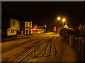
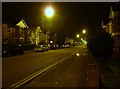
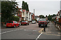
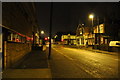
Photos of BH3 7LN


Area Information
Living in BH3 7LN offers a distinct experience within the Winton East ward of Bournemouth, Dorset. This specific postcode covers a small residential cluster with a total area size of 2455 square metres, housing a population of 1840 people. The density of 749,404 people per square kilometre indicates a highly concentrated neighbourhood, typical of a specific cluster rather than a sprawling suburb. The ward sits at the junction of eastern Winton and western Charminster, blending local histories dating back to the late 19th century with modern urban living. Winton became a separate civil parish on 31 December 1894, formed from part of Holdenhurst, before merging with Bournemouth in 1902. Residents appreciate the administrative distinctness of the area, which elected two councillors to Bournemouth, Christchurch and Poole Council from 2019. The local environment includes Winton Recreation Ground, officially opened in 1906, and a library established in 1907. These features contribute to the daily rhythm of life in this compact zone. While the area is small, its integration into the wider Bournemouth borough provides access to broader amenities without losing the compactness of its residential cluster. The history of the parish evolving into a modern ward adds depth to the character of homes here. For those seeking a location with a defined administrative identity and a clear transition from Victorian administrative changes to contemporary living, this postcode represents a slice of Bournemouth's ongoing evolution.
- Area Type
- Postcode
- Area Size
- 2455 m²
- Population
- Not available
- Population Density
- Not available
The property market in BH3 7LN reflects the specific needs of its young adult population. With 52% home ownership, the area maintains a significant base of owner-occupiers, yet the remaining market is dominated by rental or shared living arrangements. Flats are the predominant accommodation type, defining the physical landscape of these homes in BH3 7LN. This layout is conducive to the high population density of 749,404 people per square kilometre, maximising space in a small residential cluster measuring 2455 square metres. For buyers searching for homes in BH3 7LN, the prevalence of flats suggests a market focused on urban convenience rather than detached suburban living. The 52% ownership rate indicates that investment opportunities exist for landlords or individuals looking to consolidate rental income, while aspiring owners can find a pathway into the market. The ward's history, which includes the establishment of Winton Urban District Council in 1897, points to a well-established infrastructure that has adapted to housing needs over a century. Given that the area is centred on eastern Winton, property values likely remain competitive due to the compact nature of the housing stock. Buyers should expect a market where size and density take precedence, offering practical living solutions within the紧凑 boundaries of the Winton East ward.
House Prices in BH3 7LN
Showing 1 properties
| Address | Type | Beds | Baths | Last Sale Price | Last Sale Date | |
|---|---|---|---|---|---|---|
| 20 Heron Court Road, Bournemouth, BH3 7LN | Semi-detached | 5 | 2 | £225,000 | May 2013 |
Energy Efficiency in BH3 7LN
Residents of BH3 7LN enjoy access to a variety of amenities within practical reach, enhancing daily convenience. Retail options are plentiful, with five major stores including Tesco Bournemouth, Co-op Charminster, and Asda Charminster offering essential grocery and shopping needs close by. For residents who prefer not to drive, five railway stations provide frequent connections to Bournemouth, Pokesdown, and Branksome, allowing easy access to broader city centres. Travelers also find two airports nearby, Bournemouth Airport and Bournemouth International Airport, facilitating domestic and international travel. Those interested in coastal living can access five ferry landing points, including Tuckton Tea Gardens Ferry Landing, Christchurch Quay Ferry Landing, and Wick Christchurch Ferry Landing. The area's retail offerings support a self-contained lifestyle, while the transport links connect BH3 7LN to the wider region. The presence of Winton Recreation Ground and the Winton library adds cultural and recreational value to the ward. This blend of retail, rail, and ferry access means that living in this small cluster does not require long commutes for everyday tasks or leisure activities.
Amenities
Schools
Families considering schools near BH3 7LN have access to a specific range of educational institutions documented in local records. Linwood School is the nearest facility listed, which operates as a special school. This designation means the institution provides tailored education for students with specific needs, ensuring close support within a single setting. The presence of a special school in the immediate vicinity of this small residential cluster suggests a dedicated provision for educational requirements without extensive travel for families living in BH3 7LN. As the area contains only this specific named school in the provided data, it does not offer a broad mix of primary or secondary general education institutions. Prospective residents must plan carefully regarding the broader educational landscape, potentially looking further afield for state-maintained primary or grammar schools common in Bournemouth. The proximity of Linwood School indicates that the local plan prioritises inclusive education within the Winton East ward boundaries. While the lack of other listed schools means less immediate variety, it also highlights the area's focus on specific community needs rather than a comprehensive catchment for all educational stages.
| Rank | School | Type | Entry gender | Ages |
|---|
Explore more schools in this area
Go to Schools tabDemographics
The community in BH3 7LN is defined by a youthful demographic profile. The median age stands at 22 years, with the most common age range falling between 15 and 29 years. This concentration of young adults shapes the social fabric of the neighbourhood, influencing everything from local activities to the types of services that operate within the ward. Home ownership stands at 52%, meaning nearly half of the residents own their property outright. This level suggests a balance between owner-occupiers and residents in shared accommodation or rental housing. Accommodation type data confirms that flats are the predominant form of housing in this postcode. This structure aligns with the high percentage of younger residents, who often prefer low-maintenance living arrangements typical of flat developments. The predominant ethnic group recorded in the area is White, though the high population density of 749,404 people per square kilometre suggests a close-knit community where neighbours know one another personally. The mix of ownership models means that the local economy likely supports both first-time buyers and those with flexible renting options. This demographic skew indicates a neighbourhood in flux, where professional lives and academic pursuits often take centre stage over traditional family-sized housing patterns.
Household Size
Accommodation Type
Tenure
Ethnic Group
Religion
Household Composition
Age
Household Deprivation
NS-SEC
Explore more demographic insights in this area
Go to Demographics tabPlanning
Planning Constraints
- Flood RiskPremium
- Ramsar Wetland SitesPremium
- Area of Outstanding Natural BeautyPremium
- Protected Nature ReservePremium
- Protected WoodlandPremium