Area Overview for BH3 7LH
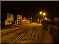
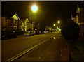
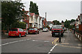
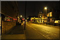
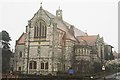
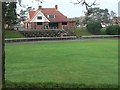
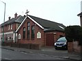
Photos of BH3 7LH


Area Information
Living in BH3 7LH places you within a specific postcode cluster covering an area of 881 square metres. This location forms part of the Talbot and Branksome Woods ward in the Bournemouth, Christchurch and Poole unitary authority. The area functions as a small residential cluster situated on the boundary between Bournemouth and Poole. It encompasses historic elements including the Talbot Village Conservation Area, which dates back to development between 1850 and 1862. The site originally served impoverished locals, featuring former farms, almshouses, and a school established in 1862. Today, the suburb blends these historic cottages with modern housing in a leafy, wooded environment. The Talbot Campus of Bournemouth University sits within the wider ward, adding an academic dimension to the local geography. Residents enjoy a suburban character defined by green, shady spaces and strong community identity. The area has evolved since the ward form was established in 2019, retaining its roots while adapting to modern needs. You are settled in a location where philosophical philanthropy from the late 19th century informs current residential patterns. The proximity to Bournemouth University and the historic charm of Talbot Village create a distinct atmosphere. This setting offers a quiet residential experience away from the busiest city centres while remaining close to major transport links. The balance of history and modernity makes this a unique spot for those seeking a grounded, community-focused living environment.
- Area Type
- Postcode
- Area Size
- 881 m²
- Population
- Not available
- Population Density
- Not available
The property market in BH3 7LH is defined by a high concentration of rental accommodation and a specific housing type. Fourty-five per cent of homes are owner-occupied, while the remaining majority consists of rental properties. This balance indicates a mixed market where some residents have established roots while others remain flexible. The accommodation type is predominantly flats, which aligns with the high population density recorded for this area. This suggests a compact living environment where units are designed for efficient use of space. If you are looking at homes in this postcode, you will likely encounter flats suited to single occupants or couples rather than large families seeking detached housing. The presence of flats within a dense residential cluster points to a design that prioritises proximity and shared amenities. This housing style often appeals to professionals who value urban conveniences alongside access to nature. The mix of ownership types means you might buy into a leasehold flat or purchase a specific property on the few owner-occupied sites. Understanding this dynamic is crucial when assessing value and potential for changes in the future. The total area of the postcode covers only 881 square metres, reinforcing the idea that this is a small, contained cluster rather than a sprawling estate. For buyers interested in the wider Talbot and Branksome Woods ward, this high-density flat culture offers an alternative to traditional suburban boomtown property markets where detached homes dominate.
House Prices in BH3 7LH
Showing 2 properties
| Address | Type | Beds | Baths | Last Sale Price | Last Sale Date | |
|---|---|---|---|---|---|---|
| 27 Heron Court Road, Bournemouth, BH3 7LH | Semi-detached | 1 | 2 | £440,000 | Mar 2016 | |
| 25 Heron Court Road, Bournemouth, BH3 7LH | Semi-detached | 6 | 2 | £335,000 | Mar 2016 |
Energy Efficiency in BH3 7LH
Daily life in BH3 7LH is enriched by a diverse range of amenities within practical reach. For shopping needs, five retail venues are nearby, including Tesco Bournemouth, Co-op Charminster, and Waitrose Winton. These supermarkets offer everything from weekly groceries to household essentials without the need for long drives. Dining and leisure options extend to five nearby rail stations which double as social hubs for commuters. Beyond shopping, the area is closely linked to five ferry landings, including Wick Christchurch Ferry Landing, connecting you to the wider Dorset coast. This variety ensures that your day-to-day requirements are met locally. The lifestyle here benefits from the integration of commercial and transport infrastructure. You do not need to travel far to access fresh produce at Tesco Bournemouth or enjoy the range of products at Waitrose Winton. The presence of multiple railway stations suggests a vibrant transit corridor where opportunity and convenience intersect. While the specific data does not detail restaurants or cinemas, the concentration of transport nodes and major supermarkets implies a well-serviced location. Living in this postcode means you have immediate access to the retail and transport networks of Bournemouth and Poole. The decline from 1862 to the present day has left a community that values both historical significance and modern accessibility.
Amenities
Schools
When considering schools near BH3 7LH, one specific institution stands out in the immediate vicinity. St Martin's School operates as an independent primary school serving the local community. The school holds a Ofsted rating of good, confirming its standards against national educational requirements. Although data regarding further education colleges or other primary institutions is not included in the provided records, the presence of St Martin's provides a clear educational option for families. The school's independent status means it operates outside the local authority school system, potentially offering different fee structures and governance models compared to state schools. The single school listing suggests that children in BH3 7LH may rely on this independent provision for early education before potentially travelling to other facilities for secondary education. The good rating from Ofsted is a key metric for parents evaluating the area for school runs. Living in this postcode places you just minutes from this educational facility, reducing commute times for daily lessons. The absence of additional school entries in the data means no other rated institutions can be confirmed for this specific cluster without further investigation. However, the existence of St Martin's demonstrates that private education options are available close by, adding diversity to the local schooling landscape. Families looking for independent education with a proven track record will find this school a viable choice within their neighbourhood.
| Rank | School | Type | Entry gender | Ages |
|---|
Explore more schools in this area
Go to Schools tabDemographics
The community in BH3 7LH reflects a mature population profile with a median age of 47 years. Most residents fall into the adult age range of 30 to 64 years. This concentration of middle-aged adults suggests a neighbourhood that attracts families and professionals past their entry into the workforce. Household structures likely reflect the needs of this demographic, prioritising stability and space. Fourty-five per cent of homes here are owner-occupied, indicating a significant base of residents with long-term ties to their properties. The remaining fifty-five per cent of the population comprises tenants renting from landlords or housing associations. Accommodation types in this postcode are predominantly flats. This distinction from detached or semi-detached housing influences the layout of daily life, particularly regarding accessibility and shared spaces. The population density reaches 2159139 people per square kilometre, a high figure that characterises the compact nature of this specific residential cluster. Despite the density, the area supports a primary ethnic group of White residents. This demographic consistency provides a sense of established community norms. The absence of significant youth populations or elderly care clusters shapes the local vibe towards active, working-age lifestyles. Specific statistics on deprivation are not referenced in the available data, so no conclusions regarding economic hardship can be drawn. Instead, demographic stability points to a settled residential environment where residents have likely lived in the area for considerable periods.
Household Size
Accommodation Type
Tenure
Ethnic Group
Religion
Household Composition
Age
Household Deprivation
NS-SEC
Explore more demographic insights in this area
Go to Demographics tabPlanning
Planning Constraints
- Flood RiskPremium
- Ramsar Wetland SitesPremium
- Area of Outstanding Natural BeautyPremium
- Protected Nature ReservePremium
- Protected WoodlandPremium