Area Overview for BH22 0NF
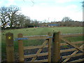
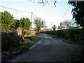
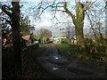
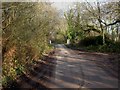
Photos of BH22 0NF
Area Information
BH22 0NF is a small residential postcode area in Dorset, England, situated within the Poole-Bournemouth conurbation. Covering 13.4 hectares, it serves as a commuter hub for nearby towns like Bournemouth, Poole, and Southampton, with a population of 1315 spread across a density of 332 people per square kilometre. The area’s character is shaped by its history as a railway settlement, with the village of West Moors nearby benefiting from proximity to the Jurassic Coast and Purbeck Hills. Daily life here balances suburban convenience with rural access, offering a quiet alternative to larger urban centres. Residents often commute to regional employment hubs, while the area’s compact size fosters a close-knit community. The postcode’s small footprint means it is tightly integrated with local amenities, from schools and shops to recreational trails like the Castleman Trailway, which follows the old railway line. With a median age of 47 and a population skewed toward adults aged 30–64, BH22 0NF reflects a mature, stable demographic, ideal for those seeking a settled lifestyle without sacrificing connectivity to nearby cities.
- Area Type
- Postcode
- Area Size
- 13.4 hectares
- Population
- 1315
- Population Density
- 332 people/km²
BH22 0NF is primarily an owner-occupied area, with 80% of residents living in homes they own. The accommodation type is predominantly houses, reflecting a residential cluster that prioritises family homes over flats or apartments. This composition suggests a market focused on long-term residency rather than short-term rental properties. The small area size (13.4 hectares) means the housing stock is limited, which could create a competitive market for buyers. However, the high home ownership rate indicates stability, with fewer properties available for purchase. For buyers, this means limited options but potentially strong equity retention. The presence of houses rather than rental-focused developments suggests a community-oriented environment, where properties are likely to be well-maintained and suited to families. Proximity to Bournemouth and Poole may also make the area attractive to commuters seeking a quieter base with easy access to larger cities.
House Prices in BH22 0NF
Showing 3 properties
| Address | Type | Beds | Baths | Last Sale Price | Last Sale Date | |
|---|---|---|---|---|---|---|
| Gullivers Little Elves And Fairies, Sturts Farm, West Moors Road, West Moors, BH22 0NF | commercial | - | - | - | - | |
| Sturts Farm, West Moors Road, West Moors, BH22 0NF | house | - | - | - | - | |
| St Johns House, Sturts Farm, West Moors Road, West Moors, BH22 0NF | Flat | - | - | - | - |
Energy Efficiency in BH22 0NF
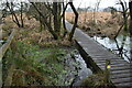
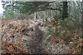
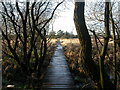
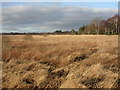
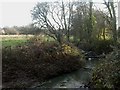
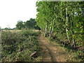
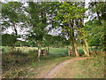
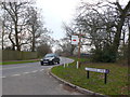
The lifestyle in BH22 0NF is defined by a blend of suburban convenience and rural accessibility. Within practical reach are five retail outlets, including Spar, Tesco West, and Morrisons Daily, providing essential shopping options. The area’s proximity to Bournemouth and Poole ensures access to larger urban amenities, from dining to entertainment. The village of West Moors retains historical elements, such as St Mary the Virgin parish church and the original railway-era level crossing gatekeeper’s cottage, adding character to daily life. The Castleman Trailway footpath offers recreational opportunities, connecting residents to nature and nearby towns. This mix of local shopping, historical landmarks, and green spaces creates a balanced lifestyle, ideal for those seeking both tranquillity and connectivity to regional hubs.
Amenities
Schools
Residents of BH22 0NF have access to two primary schools within the area: West Moors, St Mary’s Church of England Voluntary Controlled First School and St Mary’s CofE First School & Nursery. Both institutions cater to early education, with the latter including nursery provision. The presence of a Church of England school alongside an academy reflects a mix of educational approaches, offering families choices between state-funded and academically focused environments. While no Ofsted ratings are provided, the availability of two primary schools within a small postcode area suggests a strong focus on local education. For families, this ensures proximity to schooling, reducing the need for long commutes. The schools’ existence also contributes to the area’s community identity, often serving as focal points for social and cultural activities.
| Rank | School | Type | Entry gender | Ages |
|---|
Explore more schools in this area
Go to Schools tabDemographics
The population of BH22 0NF is predominantly adults aged 30–64, with a median age of 47. This age group constitutes the majority, reflecting a community of established residents rather than a transient population. Home ownership is high at 80%, with the majority of properties being houses rather than flats or apartments. The predominant ethnic group is White, aligning with broader demographic trends in the region. The area’s population density of 332 people per square kilometre suggests a moderately compact settlement, though its small size (13.4 hectares) means it is not densely packed. This density supports a balance between private space and community interaction. The age profile indicates a mature demographic, which may influence local services and amenities, such as healthcare and leisure options tailored to older residents. The high home ownership rate suggests a stable housing market, with fewer rental properties, potentially offering long-term security for homeowners.
Household Size
Accommodation Type
Tenure
Ethnic Group
Religion
Household Composition
Age
Household Deprivation
NS-SEC
Explore more demographic insights in this area
Go to Demographics tabPlanning
Planning Constraints
- Flood RiskPremium
- Ramsar Wetland SitesPremium
- Area of Outstanding Natural BeautyPremium
- Protected Nature ReservePremium
- Protected WoodlandPremium