Area Overview for BH21 3EA
Photos of BH21 3EA
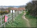
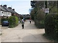
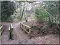
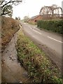

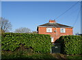
31 photos from this area
Area Information
Key information about the BH21 3EA including its size, population, and administrative classification.
- Area Type
- Postcode
- Area Size
- 3.6 hectares
- Population
- 1331
- Population Density
- 873 people/km²
House Prices in BH21 3EA
16
Properties
£521,905
Average Sold Price
£249,950
Lowest Price
£865,000
Highest Price
Showing 16 properties
| Address | Type | Beds | Baths | Last Sale Price | Last Sale Date | |
|---|---|---|---|---|---|---|
| 88 Wimborne Road, Corfe Mullen, BH21 3EA | house | 5 | 2 | £775,000 | Feb 2025 | |
| 74 Wimborne Road, Corfe Mullen, BH21 3EA | Cottage | 4 | 2 | £865,000 | Jun 2021 | |
| 102 Wimborne Road, Corfe Mullen, BH21 3EA | Detached | - | - | £570,000 | Dec 2019 | |
| 98A Wimborne Road, Corfe Mullen, BH21 3EA | Bungalow | - | - | £525,000 | Jul 2019 | |
| Pine House, 102B Wimborne Road, Corfe Mullen, BH21 3EA | Detached | 3 | - | £430,000 | May 2019 | |
| 96A Wimborne Road, Corfe Mullen, BH21 3EA | Bungalow | - | - | £550,000 | May 2019 | |
| 98 Wimborne Road, Corfe Mullen, BH21 3EA | Chalet | 3 | 1 | £476,000 | Feb 2019 | |
| 100 Wimborne Road, Corfe Mullen, BH21 3EA | house | - | - | £615,000 | Jun 2018 | |
| 96 Wimborne Road, Corfe Mullen, BH21 3EA | house | - | - | £249,950 | Oct 2013 | |
| 84 Wimborne Road, Corfe Mullen, BH21 3EA | Detached | - | - | £355,000 | Oct 2007 |
Page 1 of 2
Energy Efficiency in BH21 3EA
Amenities
Schools
| Rank | School | Type | Entry gender | Ages |
|---|
Explore more schools in this area
Go to Schools tabDemographics
Household Size
Two person
most common
Accommodation Type
Houses
most common
Tenure
89
majority
Ethnic Group
White
most common
Religion
N/A
most common
Household Composition
N/A
most common
Age
47
median
Adults (30-64 years)
most common
Household Deprivation
N/A
with no deprivation
NS-SEC
40
in Lower managerial occupations
Explore more demographic insights in this area
Go to Demographics tabPlanning
Planning Constraints
- Flood RiskPremium
- Ramsar Wetland SitesPremium
- Area of Outstanding Natural BeautyPremium
- Protected Nature ReservePremium
- Protected WoodlandPremium