Area Overview for BH20 6PA
Photos of BH20 6PA
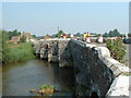

![Woolbridge Manor [1] in BH20 6PA](https://images.propbar.co.uk/images/geograph/72/56/7256908_120.jpg)
![Woolbridge Manor [2] in BH20 6PA](https://images.propbar.co.uk/images/geograph/72/56/7256909_120.jpg)
![Woolbridge Manor [3] in BH20 6PA](https://images.propbar.co.uk/images/geograph/72/56/7256910_120.jpg)
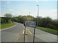
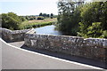
![Woolbridge Manor [4] in BH20 6PA](https://images.propbar.co.uk/images/geograph/72/56/7256911_120.jpg)
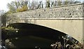
![Woolbridge Manor [5] in BH20 6PA](https://images.propbar.co.uk/images/geograph/72/56/7256912_120.jpg)
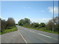
![Woolbridge Manor [6] in BH20 6PA](https://images.propbar.co.uk/images/geograph/72/56/7256913_120.jpg)
38 photos from this area
Area Information
Key information about the BH20 6PA including its size, population, and administrative classification.
- Area Type
- Postcode
- Area Size
- 3.6 hectares
- Population
- 1314
- Population Density
- 26 people/km²
House Prices in BH20 6PA
4
Properties
£349,333
Average Sold Price
£265,000
Lowest Price
£435,000
Highest Price
Showing 4 properties
| Address | Type | Beds | Baths | Last Sale Price | Last Sale Date | |
|---|---|---|---|---|---|---|
| 2 Lytchett Lane, Bovington, BH20 6PA | Bungalow | - | - | £435,000 | Jul 2016 | |
| Steps, 1 Lytchett Lane, Bovington, BH20 6PA | Detached | 4 | - | £348,000 | Oct 2007 | |
| 3 Lytchett Lane, Bovington, BH20 6PA | Detached | - | - | £265,000 | Dec 2003 | |
| Annexe, 2 Lytchett Lane, Bovington, BH20 6PA | Flat | - | - | - | - |
Energy Efficiency in BH20 6PA
Amenities
Schools
| Rank | School | Type | Entry gender | Ages |
|---|
Explore more schools in this area
Go to Schools tabDemographics
Household Size
Two person
most common
Accommodation Type
Houses
most common
Tenure
54
majority
Ethnic Group
White
most common
Religion
N/A
most common
Household Composition
N/A
most common
Age
47
median
Adults (30-64 years)
most common
Household Deprivation
N/A
with no deprivation
NS-SEC
38
in Lower managerial occupations
Explore more demographic insights in this area
Go to Demographics tabPlanning
Planning Constraints
- Flood RiskPremium
- Ramsar Wetland SitesPremium
- Area of Outstanding Natural BeautyPremium
- Protected Nature ReservePremium
- Protected WoodlandPremium