Area Overview for BH20 6NP
Photos of BH20 6NP
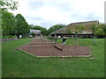
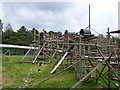
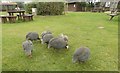
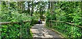
57 photos from this area
Area Information
Key information about the BH20 6NP including its size, population, and administrative classification.
- Area Type
- Postcode
- Area Size
- 5.0 hectares
- Population
- 2564
- Population Density
- 402 people/km²
House Prices in BH20 6NP
34
Properties
£179,838
Average Sold Price
£52,000
Lowest Price
£370,000
Highest Price
Showing 34 properties
| Address | Type | Beds | Baths | Last Sale Price | Last Sale Date | |
|---|---|---|---|---|---|---|
| 66 Cologne Road, Bovington, BH20 6NP | Semi-detached | 3 | 3 | £350,000 | Jan 2025 | |
| 74 Cologne Road, Bovington, BH20 6NP | Semi-detached | 3 | 2 | £345,000 | Aug 2024 | |
| 104 Cologne Road, Bovington, BH20 6NP | house | - | - | £370,000 | Aug 2023 | |
| 54 Cologne Road, Bovington, BH20 6NP | Semi-detached | 3 | - | £227,000 | Aug 2017 | |
| 60 Cologne Road, Bovington, BH20 6NP | house | - | - | £198,000 | Dec 2016 | |
| 96 Cologne Road, Bovington, BH20 6NP | Semi-detached | 3 | - | £224,000 | Sep 2016 | |
| 86 Cologne Road, Bovington, BH20 6NP | Semi-detached | - | - | £190,000 | Aug 2004 | |
| 92 Cologne Road, Bovington, BH20 6NP | Semi-detached | - | - | £129,950 | Jun 2002 | |
| 46 Cologne Road, Bovington, BH20 6NP | Semi-detached | - | - | £75,000 | Feb 2000 | |
| 50 Cologne Road, Bovington, BH20 6NP | Semi-detached | - | - | £59,950 | Aug 1999 |
Page 1 of 4
Energy Efficiency in BH20 6NP
Amenities
Schools
| Rank | School | Type | Entry gender | Ages |
|---|
Explore more schools in this area
Go to Schools tabDemographics
Household Size
Family (3-5 people)
most common
Accommodation Type
Houses
most common
Tenure
40
majority
Ethnic Group
White
most common
Religion
N/A
most common
Household Composition
N/A
most common
Age
22
median
Adults (30-64 years)
most common
Household Deprivation
N/A
with no deprivation
NS-SEC
35
in Lower managerial occupations
Explore more demographic insights in this area
Go to Demographics tabPlanning
Planning Constraints
- Flood RiskPremium
- Ramsar Wetland SitesPremium
- Area of Outstanding Natural BeautyPremium
- Protected Nature ReservePremium
- Protected WoodlandPremium