Area Overview for BH2 5EB
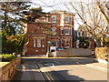
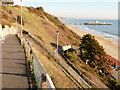
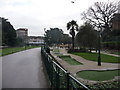
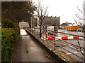
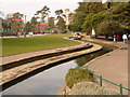
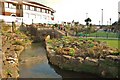
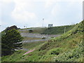
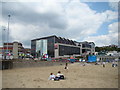
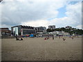
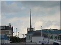
Photos of BH2 5EB


Area Information
Living in BH2 5EB offers a specific residential experience within the ward of Westbourne and West Cliff, located in the south west of Bournemouth, Dorset. This postcode covers a small residential cluster spanning 1,816 square metres and hosts approximately 2,453 people. The area sits adjacent to Canford Cliffs in neighbouring Poole, serving as an affluent suburban district just outside Bournemouth Town Centre. Since 2019, the ward has elected two councillors to represent residents to Bournemouth, Christchurch and Poole Council. The character remains distinctly residential and suburban, maintaining a balance between quiet living and proximity to the town's amenities. History shapes the local identity, with land originally transferred into private ownership under the Christchurch Inclosure Act 1802. Sir George Ivison Tapps later purchased significant acres to plant pine trees, aiding the region's development as a seaside health resort. By 1835, his son developed the estate into a resort, and the West Cliff Railway opened in 1908 to serve the promenade. Westbourne Library opened on 11th May 1916 to serve the community. Historical structures like Zetland Court on Alumhurst Road reflect the area's prosperous past, though local observations in 2018 noted concerns regarding socioeconomic trajectory. Today, the area stands as one of Bournemouth's more prosperous districts, offering established transport infrastructure within a major coastal town.
- Area Type
- Postcode
- Area Size
- 1816 m²
- Population
- 2453
- Population Density
- 5494 people/km²
The property market in BH2 5EB is defined by a heavy reliance on rental accommodation, evidenced by the fact that only 35% of households are owner-occupied. Flats constitute the predominant accommodation type within this postcode, which covers a small 1,816 square metre area. This structure distinguishes the market from traditional suburban estates where detached houses and high home ownership rates are typical. The low ownership percentage suggests the area attracts investors, professionals on temporary contracts, or those seeking flexibility in a major coastal town. Prospective buyers looking at homes in BH2 5EB should note the prevalence of flats over freehold homes. The ward characterises itself as affluent and suburban, yet the housing stock leans heavily towards leasehold flats. This reality impacts transaction speeds, service charges, and management dynamics compared to owner-occupied properties. The area sits within Bournemouth, a major coastal town with established transport infrastructure, which often drives demand for investment-grade properties. While the ward is considered one of the more prosperous districts, the specific postcode's composition of flats means buyers face a different acquisition process than typical family houses. The mix of ownership types creates a fluid market where rental yields can be significant, but capital growth for individual flats may vary based on broader property market trends in Bournemouth.
House Prices in BH2 5EB
Showing 5 properties
| Address | Type | Beds | Baths | Last Sale Price | Last Sale Date | |
|---|---|---|---|---|---|---|
| Flat 4, 56 St Michaels Road, Bournemouth, BH2 5EB | Flat | 1 | 10 | - | - | |
| Flat 5, 56 St Michaels Road, Bournemouth, BH2 5EB | Flat | - | - | - | - | |
| Flat 3, 56 St Michaels Road, Bournemouth, BH2 5EB | Flat | - | - | - | - | |
| Flat 1, 56 St Michaels Road, Bournemouth, BH2 5EB | Flat | - | - | - | - | |
| Flat 2, 56 St Michaels Road, Bournemouth, BH2 5EB | Flat | - | - | - | - |
Energy Efficiency in BH2 5EB
Daily life in BH2 5EB provides convenient access to a range of amenities within practical reach. On the retail front, residents are near Tesco Bournemouth, Co-op Bournemouth, and other local shops, ensuring essentials are easily accessible. For travel, five railway stations are nearby, including Bournemouth Railway Station, Branksome Railway Station, and Pokesdown Railway Station. Ferry services connect to Sandbanks Ferry Terminal, Brownsea Island Ferry Landing, and Shell Bay Ferry Terminal, offering coastal access. Air travel is supported by two nearby airports: Bournemouth Airport and Bournemouth International Airport. The area's history includes notable features such as Zetland Court on Alumhurst Road, originally built as Branksome Dene in the 1840s. The West Cliff Railway, opened in 1908, continues to serve the promenade. Westbourne Library, opened on 11th May 1916, remains a community hub. Alum Chine also features in local heritage discussions. This mix of historic buildings, transport links, and retail options defines the convenience of the ward. The affluent suburban character complements the availability of these services, creating a lifestyle that balances quiet residential living with proximity to Bournemouth's broader amenities.
Amenities
Schools
Families living in BH2 5EB have access to local educational facilities, with St Michael's Church of England Primary School serving the area. This institution is situated near the postcode and holds an Ofsted rating of 'good'. As the data confirms, this primary school is a key feature for families considering moving to the ward. Currently, the available data lists only St Michael's Church of England Primary School with an explicit 'good' rating. There are no secondary schools or other primary institutions listed in the provided information for this specific postcode. This gap in the immediate school network suggests residents may need to look further afield for secondary education or consider the catchment areas of neighbouring wards. The presence of a single listed primary school indicates a neigbourhood where families rely on that specific facility, or where the data recording for other schools in the immediate vicinity is absent. Parents must verify catchment boundaries and transport links for secondary schools, as the dataset does not provide names or ratings for institutions beyond St Michael's.
| Rank | School | Type | Entry gender | Ages |
|---|
Explore more schools in this area
Go to Schools tabDemographics
The community in BH2 5EB consists of a resident population with a median age of 47 years. Adults aged between 30 and 64 years form the most common age range, indicating a household profile often supported by working-age individuals with families or those approaching retirement. Housing patterns show that flats are the predominant accommodation type within this specific postcode cluster. Home ownership stands at 35%, meaning a significant majority of households rely on private renting rather than owning their residences outright. The predominant ethnic group in the area is White, reflecting the broader demographic composition of the local ward while maintaining specific characteristics for this residential cluster. While the area represents relative prosperity with a higher population density compared to wider rural Dorset, the high proportion of renters suggests a dynamic housing market influenced by investment and professional letting. The age profile suggests stability, with fewer young children under five or elderly over 85 compared to the middle-aged core. This demographic mix supports local services geared towards younger families and established professionals rather than holidaymakers or pensioners. The population size of 2,453 creates a concentrated community feel where residents interact more frequently than in wider dispersal areas.
Household Size
Accommodation Type
Tenure
Ethnic Group
Religion
Household Composition
Age
Household Deprivation
NS-SEC
Explore more demographic insights in this area
Go to Demographics tabPlanning
Planning Constraints
- Flood RiskPremium
- Ramsar Wetland SitesPremium
- Area of Outstanding Natural BeautyPremium
- Protected Nature ReservePremium
- Protected WoodlandPremium