Area Overview for BH2 5PH
Photos of BH2 5PH
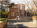
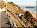
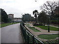
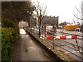


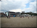

100 photos from this area
Area Information
Key information about the BH2 5PH including its size, population, and administrative classification.
- Area Type
- Postcode
- Area Size
- 7342 m²
- Population
- 2453
- Population Density
- 5494 people/km²
House Prices in BH2 5PH
47
Properties
£172,000
Average Sold Price
£99,000
Lowest Price
£245,000
Highest Price
Showing 47 properties
| Address | Type | Beds | Baths | Last Sale Price | Last Sale Date | |
|---|---|---|---|---|---|---|
| 8, West Cliff Apartments, 131 West Hill Road, Bournemouth, BH2 5PH | Flat | 2 | 1 | £99,000 | May 2010 | |
| 121 West Hill Road, Bournemouth, BH2 5PH | Flat | 14 | 10 | £245,000 | Jan 2002 | |
| 7, Lancaster Court, 113-115 West Hill Road, Bournemouth, BH2 5PH | Flat | - | 1 | - | - | |
| 3, Oakwood House, 117-119 West Hill Road, Bournemouth, BH2 5PH | Flat | 1 | 1 | - | - | |
| 4, Lancaster Court, 113-115 West Hill Road, Bournemouth, BH2 5PH | Flat | - | 1 | - | - | |
| 13, Lancaster Court, 113-115 West Hill Road, Bournemouth, BH2 5PH | Flat | 1 | 1 | - | - | |
| Staff Accomodation, Lloyds Hotel, 123 West Hill Road, Bournemouth, BH2 5PH | Terraced | 14 | 12 | - | - | |
| 6, Oakwood House, 117-119 West Hill Road, Bournemouth, BH2 5PH | Flat | 1 | 1 | - | - | |
| 15, Lancaster Court, 113-115 West Hill Road, Bournemouth, BH2 5PH | Flat | - | - | - | - | |
| 17, Lancaster Court, 113-115 West Hill Road, Bournemouth, BH2 5PH | Flat | 1 | 1 | - | - |
Page 1 of 5
Energy Efficiency in BH2 5PH
Amenities
Schools
| Rank | School | Type | Entry gender | Ages |
|---|
Explore more schools in this area
Go to Schools tabDemographics
Household Size
One person
most common
Accommodation Type
Flats
most common
Tenure
35
majority
Ethnic Group
White
most common
Religion
N/A
most common
Household Composition
N/A
most common
Age
47
median
Adults (30-64 years)
most common
Household Deprivation
N/A
with no deprivation
NS-SEC
31
in Lower managerial occupations
Explore more demographic insights in this area
Go to Demographics tabPlanning
Planning Constraints
- Flood RiskPremium
- Ramsar Wetland SitesPremium
- Area of Outstanding Natural BeautyPremium
- Protected Nature ReservePremium
- Protected WoodlandPremium