Area Overview for BH18 9AH
Photos of BH18 9AH


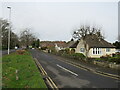


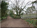


14 photos from this area
Area Information
Key information about the BH18 9AH including its size, population, and administrative classification.
- Area Type
- Postcode
- Area Size
- 34.4 hectares
- Population
- 1450
- Population Density
- 1089 people/km²
House Prices in BH18 9AH
23
Properties
£538,395
Average Sold Price
£194,500
Lowest Price
£1,060,000
Highest Price
Showing 23 properties
| Address | Type | Beds | Baths | Last Sale Price | Last Sale Date | |
|---|---|---|---|---|---|---|
| 100 Higher Blandford Road, Poole, BH18 9AH | Detached | 5 | 2 | £795,000 | Nov 2025 | |
| 86 Higher Blandford Road, Poole, BH18 9AH | Detached | 5 | 3 | £1,060,000 | Apr 2025 | |
| 64 Higher Blandford Road, Poole, BH18 9AH | Detached | 4 | 4 | £730,000 | Nov 2023 | |
| 96 Higher Blandford Road, Poole, BH18 9AH | Detached | 4 | 2 | £710,000 | Dec 2018 | |
| 66 Higher Blandford Road, Poole, BH18 9AH | house | - | - | £575,000 | Aug 2017 | |
| 82 Higher Blandford Road, Poole, BH18 9AH | house | - | - | £700,000 | Apr 2017 | |
| 68 Higher Blandford Road, Poole, BH18 9AH | Detached | 4 | - | £440,000 | Apr 2015 | |
| 60 Higher Blandford Road, Poole, BH18 9AH | Detached | 5 | - | £580,000 | Feb 2015 | |
| 84 Higher Blandford Road, Poole, BH18 9AH | house | - | - | £415,000 | Apr 2010 | |
| 58 Higher Blandford Road, Poole, BH18 9AH | house | - | - | £388,000 | Apr 2010 |
Page 1 of 3
Energy Efficiency in BH18 9AH
Amenities
Schools
| Rank | School | Type | Entry gender | Ages |
|---|
Explore more schools in this area
Go to Schools tabDemographics
Household Size
Two person
most common
Accommodation Type
Houses
most common
Tenure
94
majority
Ethnic Group
White
most common
Religion
N/A
most common
Household Composition
N/A
most common
Age
47
median
Adults (30-64 years)
most common
Household Deprivation
N/A
with no deprivation
NS-SEC
43
in Lower managerial occupations
Explore more demographic insights in this area
Go to Demographics tabPlanning
Planning Constraints
- Flood RiskPremium
- Ramsar Wetland SitesPremium
- Area of Outstanding Natural BeautyPremium
- Protected Nature ReservePremium
- Protected WoodlandPremium