Area Overview for BH18 8DQ
Photos of BH18 8DQ


Area Information
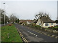
Living in BH18 8DQ, a small residential cluster in Poole, Dorset, offers a blend of suburban convenience and natural surroundings. The area spans 8.2 hectares, housing 1,555 residents in a densely populated yet compact setting, with 771 people per square kilometre. Broadstone, the area’s heart, is centred on The Broadway, a road lined with shops, schools, and community hubs. Its proximity to Hamworthy railway station (3 miles away) and Bournemouth International Airport (7 miles) makes it accessible for commuters and travellers. The area’s character is defined by 20th-century housing estates, heathland, and a strong sense of community, with events like the annual Christmas parade. While small, it balances suburban life with nearby countryside, offering both urban amenities and open spaces. Residents benefit from a mix of retail, transport, and greenery, making it appealing for those seeking a connected yet tranquil lifestyle.
- Area Type
- Postcode
- Area Size
- 8.2 hectares
- Population
- 1555
- Population Density
- 771 people/km²
BH18 8DQ is predominantly an owner-occupied area, with 87% of homes owned by residents rather than rented. The accommodation type is primarily houses, which contrasts with areas dominated by flats or apartments. This suggests a housing stock suited to families or individuals seeking more space, though the small area size (8.2 hectares) means the market is limited. Buyers should consider the scarcity of properties, which could drive competition. The high home ownership rate indicates stability, but the small footprint of the area means proximity to Poole or Bournemouth may be necessary for larger property searches. For those prioritising family homes, BH18 8DQ offers a compact, established option, though its size may restrict availability for specific needs.
House Prices in BH18 8DQ
Showing 1 properties
| Address | Type | Beds | Baths | Last Sale Price | Last Sale Date | |
|---|---|---|---|---|---|---|
| Club House, Broadstone Golf Club, Wentworth Drive, Poole, BH18 8DQ | pub | - | - | - | - |
Energy Efficiency in BH18 8DQ
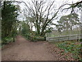
Residents of BH18 8DQ have access to a range of amenities within practical reach. The area includes five retail spots, such as Tesco Broadstone and M&S Broadstone, offering everyday shopping. Three railway stations and ferry terminals provide transport links to Poole, Bournemouth, and the coast. Broadstone Heath, a 24-acre park, offers recreational space, while the area’s heathland and countryside provide walking opportunities. The Broadway serves as a local hub with shops and community events. The mix of retail, transport, and green spaces supports a convenient lifestyle, blending suburban comfort with natural beauty. The presence of clubs and annual events like the Christmas parade further enhances the area’s community feel, making daily life both practical and sociable.
Amenities
Schools
Near BH18 8DQ are two schools named Broadstone Middle School: one is a primary school, and the other is an academy with a ‘good’ Ofsted rating. This duplication suggests a focus on education in the area, though it is unclear if they serve different age groups or are separate institutions. The presence of an academy with a strong rating provides families with a quality option for secondary education, while the primary school caters to younger children. The limited number of schools, however, means families may need to consider commuting to nearby areas for additional choices. The data does not specify enrollment numbers or catchment areas, but the availability of a rated academy indicates a commitment to education in Broadstone.
| Rank | School | Type | Entry gender | Ages |
|---|
Explore more schools in this area
Go to Schools tabDemographics
The population of BH18 8DQ has a median age of 47, with the majority aged 30–64. This suggests a mature, stable community, likely with families and professionals. Home ownership is high at 87%, with most properties being houses rather than flats, indicating a preference for family-friendly, long-term living. The predominant ethnic group is White, reflecting the area’s demographic profile. With 1,555 residents in a small area, the population density of 771 people per square kilometre implies a tightly knit community. While this density could mean limited space for expansion, it also fosters neighbourly interactions. The age profile suggests a mix of working-age adults and retirees, contributing to a balanced local economy. The data does not indicate significant deprivation, but the high home ownership rate and age range suggest a relatively affluent, settled population.
Household Size
Accommodation Type
Tenure
Ethnic Group
Religion
Household Composition
Age
Household Deprivation
NS-SEC
Explore more demographic insights in this area
Go to Demographics tabPlanning
Planning Constraints
- Flood RiskPremium
- Ramsar Wetland SitesPremium
- Area of Outstanding Natural BeautyPremium
- Protected Nature ReservePremium
- Protected WoodlandPremium