Area Overview for BH15 2PB
Photos of BH15 2PB

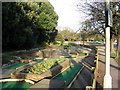


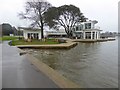

73 photos from this area
Area Information
Key information about the BH15 2PB including its size, population, and administrative classification.
- Area Type
- Postcode
- Area Size
- 6873 m²
- Population
- Not available
- Population Density
- Not available
House Prices in BH15 2PB
14
Properties
£193,838
Average Sold Price
£4,500
Lowest Price
£346,030
Highest Price
Showing 14 properties
| Address | Type | Beds | Baths | Last Sale Price | Last Sale Date | |
|---|---|---|---|---|---|---|
| 133A Parkstone Road, Poole, BH15 2PB | Flat | - | - | £285,000 | Nov 2024 | |
| 129A Parkstone Road, Poole, BH15 2PB | Flat | - | - | £4,500 | Sep 2016 | |
| 137A Parkstone Road, Poole, BH15 2PB | Flat | - | - | £130,000 | Mar 2009 | |
| 123A Parkstone Road, Poole, BH15 2PB | Flat | - | - | £346,030 | Oct 2006 | |
| 125A Parkstone Road, Poole, BH15 2PB | Flat | - | - | £265,000 | Nov 2003 | |
| 117A Parkstone Road, Poole, BH15 2PB | Flat | - | - | £132,500 | Jun 2001 | |
| 131A Parkstone Road, Poole, BH15 2PB | Flat | 2 | 1 | - | - | |
| First Floor Flat, 121 Parkstone Road, Poole, BH15 2PB | Flat | - | - | - | - | |
| 127A Parkstone Road, Poole, BH15 2PB | Flat | - | - | - | - | |
| 119A Parkstone Road, Poole, BH15 2PB | Office | - | - | - | - |
Page 1 of 2
Energy Efficiency in BH15 2PB
Amenities
Schools
| Rank | School | Type | Entry gender | Ages |
|---|
Explore more schools in this area
Go to Schools tabDemographics
Household Size
Two person
most common
Accommodation Type
Houses
most common
Tenure
66
majority
Ethnic Group
White
most common
Religion
N/A
most common
Household Composition
N/A
most common
Age
47
median
Adults (30-64 years)
most common
Household Deprivation
N/A
with no deprivation
NS-SEC
37
in Lower managerial occupations
Explore more demographic insights in this area
Go to Demographics tabPlanning
Planning Constraints
- Flood RiskPremium
- Ramsar Wetland SitesPremium
- Area of Outstanding Natural BeautyPremium
- Protected Nature ReservePremium
- Protected WoodlandPremium