Area Overview for BH15 2PA
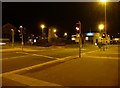
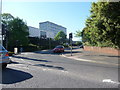
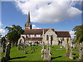
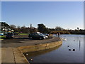
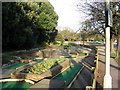
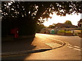
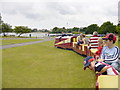
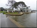
Photos of BH15 2PA


Area Information
The high-level post code BH15 2PA sits within the Poole Town Ward, a distinct residential cluster located on the northern and eastern edges of Poole Harbour. This specific postcode area covers just 1,727 square metres yet houses 1,778 residents, reflecting a high concentration of living space in this established part of the town. The location is approximately 0.1 kilometres from the sea, placing it directly adjacent to one of the largest natural harbours in the English Channel. Historically, this region developed around Poole Quay, once the busy centre of maritime industry before port activities moved to Hamworthy in the 1970s. Today, the ward encompasses Poole Town Centre, Longfleet, and Baiter Park, serving as a gateway to the Jurassic Coast World Heritage Site. You live in an urban coastal environment defined by its proximity to the water and its history. The area attracts visitors to its large natural harbour and Blue Flag beaches while locals enjoy access to the Lighthouse arts centre. Living in BH15 2PA means being close to the historic quay lined with traditional pubs and listed buildings, alongside modern apartment blocks. The coordinates 50.71556, -1.985656 confirm its precise position on the harbour fringe. This small but significant post code offers a blend of residential stability and coastal charm, situated within the Bournemouth, Christchurch and Poole unitary authority description.
- Area Type
- Postcode
- Area Size
- 1727 m²
- Population
- Not available
- Population Density
- Not available
The housing market within BH15 2PA is predominantly characterised by owner-occupied stock rather than private rental properties. With 66% of households owning their homes, you find a market where long-term stability is the norm. The predominant accommodation type in this postcode is houses, suggesting the availability of traditional family living spaces rather than a concentration of small urban flats. This ownership rate of 66% indicates that the area appeals to buyers seeking to settle down, possibly attracted by the proximity to Poole Harbour and the established nature of the Poole Town Ward. You do not encounter the transient nature often found in student-heavy zones or pure rental enclaves. The mix of historic Old Town architecture and modern apartment blocks near the quay offers varied options, yet the core statistic of house ownership remains dominant. Average household income in the wider postcode area reached £43,200 in 2020, a figure that supports the owner-occupier demographic. While average property prices in Bournemouth hit £358,229, the local stock in BH15 2PA tends to reflect this broader trend of established home values. Buying here means entering a market where the majority of sellers are existing homeowners looking to trade up or move on, rather than landlords managing tenancies.
House Prices in BH15 2PA
Showing 12 properties
Energy Efficiency in BH15 2PA
Daily life for you in BH15 2PA centres on convenience and access to key services without the need for long commutes. Within practical reach, you have five retail options, including M&S Poole Hospital, The Southern Co-operative Co-op 25, and Co-op Poole. These supermarkets and local shops provide everything from groceries to household essentials just outside the door. Transport links are extensive, with five rail connections nearby, including Parkstone Railway Station, Poole Railway Station, and Branksome Railway Station. For those with coastal interests or domestic holidays, five ferry services operate close by, such as Poole Quay Ferry Landing, Poole Ferry Terminal, and Brownsea Island Ferry Landing. Brownsea Island, the largest of eight harbour islands and owned by the National Trust, is approximately a 20-minute ferry journey away. The town centre hosts the main shopping and entertainment facilities, with Poole Quay lined with traditional public houses, listed buildings, and bars. You are situated in an urban classification nearer to a major town or city. The Arts University Bournemouth, a significant portion of Bournemouth University, and the Bournemouth Symphony Orchestra are all located in Poole, adding cultural depth to your lifestyle. Access to the Jurassic Coast UNESCO World Heritage Site puts natural history and outdoor exploration within easy reach.
Amenities
Schools
| Rank | School | Type | Entry gender | Ages |
|---|
Explore more schools in this area
Go to Schools tabDemographics
The community inside BH15 2PA reflects the profile of an established coastal town household. The median age of residents is 47 years, with adults aged between 30 and 64 years comprising the most common age range. This demographic suggests a mature population likely settled for the long term. Home ownership stands at 66%, a figure significantly higher than the national average for rental-dense cities. The predominant accommodation type consists of houses, indicating a stock that has endured through decades of development rather than a transient high-rise living pattern. The predominant ethnic group is White, consistent with the demographic makeup of much of Dorset. You cast a distinct community founded on stability and longevity. The data shows a clear preference for ownership over renting, with two-thirds of residents owning their homes. This implies a neighbourhood where families and individuals, particularly those in the middle to later stages of life, have rooted themselves deeply. The population density is high relative to the small land area of 1,727 square metres, yet the character remains residential. Living in BH15 2PA means joining a community where the majority of households have secured their own properties.
Household Size
Accommodation Type
Tenure
Ethnic Group
Religion
Household Composition
Age
Household Deprivation
NS-SEC
Explore more demographic insights in this area
Go to Demographics tabPlanning
Planning Constraints
- Flood RiskPremium
- Ramsar Wetland SitesPremium
- Area of Outstanding Natural BeautyPremium
- Protected Nature ReservePremium
- Protected WoodlandPremium