Area Overview for BH13 7RH
Photos of BH13 7RH
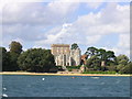

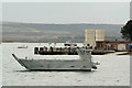
100 photos from this area
Area Information
Key information about the BH13 7RH including its size, population, and administrative classification.
- Area Type
- Postcode
- Area Size
- 1.7 hectares
- Population
- 1525
- Population Density
- 1229 people/km²
House Prices in BH13 7RH
38
Properties
£779,780
Average Sold Price
£110,000
Lowest Price
£1,600,000
Highest Price
Showing 38 properties
| Address | Type | Beds | Baths | Last Sale Price | Last Sale Date | |
|---|---|---|---|---|---|---|
| Leeward, 8 Grasmere Road, Poole, BH13 7RH | Detached | 4 | - | £1,400,000 | Dec 2020 | |
| 29 Grasmere Road, Poole, BH13 7RH | Detached | 5 | 4 | £1,120,000 | Oct 2020 | |
| 10A Grasmere Road, Poole, BH13 7RH | Detached | 4 | 3 | £1,130,000 | Oct 2018 | |
| 20 Grasmere Road, Poole, BH13 7RH | Detached | 4 | 3 | £995,000 | Oct 2018 | |
| 10 Grasmere Road, Poole, BH13 7RH | Detached | 4 | 3 | £1,200,000 | Nov 2017 | |
| 17 Grasmere Road, Poole, BH13 7RH | Detached | 3 | - | £700,000 | Apr 2017 | |
| 27 Grasmere Road, Poole, BH13 7RH | Detached | 4 | - | £910,000 | Apr 2017 | |
| 23 Grasmere Road, Poole, BH13 7RH | Detached | 5 | 3 | £640,000 | Aug 2016 | |
| Windward, 8A Grasmere Road, Poole, BH13 7RH | house | - | - | £1,300,000 | Jun 2016 | |
| 7 Grasmere Road, Poole, BH13 7RH | house | - | - | £1,300,000 | Jun 2016 |
Page 1 of 4
Energy Efficiency in BH13 7RH
Amenities
Schools
| Rank | School | Type | Entry gender | Ages |
|---|
Explore more schools in this area
Go to Schools tabDemographics
Household Size
Two person
most common
Accommodation Type
Flats
most common
Tenure
72
majority
Ethnic Group
White
most common
Religion
N/A
most common
Household Composition
N/A
most common
Age
47
median
Adults (30-64 years)
most common
Household Deprivation
N/A
with no deprivation
NS-SEC
49
in Lower managerial occupations
Explore more demographic insights in this area
Go to Demographics tabPlanning
Planning Constraints
- Flood RiskPremium
- Ramsar Wetland SitesPremium
- Area of Outstanding Natural BeautyPremium
- Protected Nature ReservePremium
- Protected WoodlandPremium