Area Overview for BH13 6DE
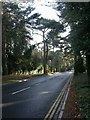
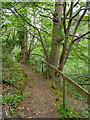
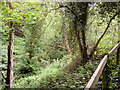
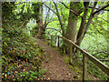
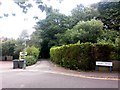
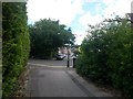
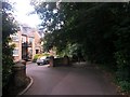
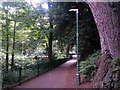
Photos of BH13 6DE
Area Information
BH13 6DE covers a specific residential cluster within the Canford Cliffs ward of Poole, Dorset. This small area spans just 2.5 hectares and holds a population of 1679 people. You are looking at a compact neighbourhood characterised by a high concentration of residents, with a population density of 68054 people per square kilometre. The location represents a residential seaside community established on what was originally Lord Wimborne's Canford Estate. The modern settlement of Canford Cliffs began in 1886, evolving from undeveloped open heathland into a structured village with roads and utilities planned from the outset. Living in this postcode means residing in an area that has evolved significantly since its Victorian heyday. The original layout featured large south-facing plots designed for wealthy buyers, though recent decades have seen a shift towards higher-density development. Many larger Victorian and Edwardian properties have been replaced by modern blocks of flats to accommodate changing needs. The area retains historic landmarks, such as Holy Angels Church built in 1873 and the Martello Tower near Canford Cliffs Chine, though the latter has been lost to cliff erosion. Daily life here is shaped by its maritime heritage and leisure focus. The shallow harbour waters support a watersports industry, particularly sail boarding, which remains a significant feature of the local character. While the original development aimed for permanence, today the economy relies heavily on residential property and holiday lettings. Approximately half the dwellings function as holiday flats or second homes, creating a dynamic but traditionally affluent atmosphere. You will find yourself in a place defined by its coastal setting and its history as a destination for those seeking seaside living.
- Area Type
- Postcode
- Area Size
- 2.5 hectares
- Population
- Not available
- Population Density
- Not available
The property market in BH13 6DE is dominated by owner-occupiers, with 82% of households owning their homes. You will find that houses remain the most common form of accommodation in this postcode area. This high ownership rate signals a distinct lack of rental pressure compared to city-centre postcodes or university towns. The market here reflects a desire for stability rather than transient living arrangements. Historical context explains much of the current stock. The development of Canford Cliffs began in 1886 when businessmen offered plots on a thoroughly planned estate. While some original Victorian and Edwardian houses survive, notably Carkeel which now stands as the Norfolk Lodge Hotel, much of the housing stock has changed. Recent decades have witnessed significant shifts in the built environment. Large plots have been subdivided, and modern blocks of flats have replaced many older single dwellings. For buyers considering BH13 6DE, the mix implies limitations on traditional detached house availability. The area was historically characterised by large south-facing plots for wealthy buyers. Today, navigating the housing market involves understanding this blend of historic grandeur and modern high-density construction. The relative shallowess of the harbour waters has influenced land use, contributing to the character of the location as a leisure destination. You should expect property values to reflect both the historic prestige of the estate and the practical realities of sea-view living and holiday letting trends.
House Prices in BH13 6DE
Showing 33 properties
| Address | Type | Beds | Baths | Last Sale Price | Last Sale Date | |
|---|---|---|---|---|---|---|
| 7A Chester Road, Poole, BH13 6DE | Flat | - | - | £397,000 | Aug 2024 | |
| 23 Chester Road, Poole, BH13 6DE | Detached | 5 | 2 | £1,225,000 | Mar 2024 | |
| 17 Chester Road, Poole, BH13 6DE | Flat | - | - | £577,000 | Nov 2022 | |
| 21 Chester Road, Poole, BH13 6DE | Detached | 5 | 3 | £1,150,000 | May 2022 | |
| 7 Chester Road, Poole, BH13 6DE | Flat | - | - | £450,000 | Dec 2020 | |
| 15 Chester Road, Poole, BH13 6DE | Detached | 5 | 2 | £945,000 | Mar 2018 | |
| 11 Chester Road, Poole, BH13 6DE | Flat | - | - | £425,000 | Jan 2018 | |
| 9B Chester Road, Poole, BH13 6DE | Flat | 2 | 1 | £240,000 | Aug 2014 | |
| 17A Chester Road, Poole, BH13 6DE | Flat | - | - | £420,000 | Jul 2012 | |
| Frestonia, 3A Chester Road, Poole, BH13 6DE | Detached | - | - | £400,000 | Jun 2006 |
Energy Efficiency in BH13 6DE
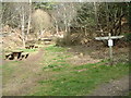
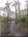
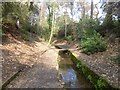
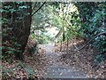
Living in BH13 6DE places you within practical reach of essential amenities and leisure facilities. Five retail options are nearby, including Tesco Poole and M&S Westbourne SF. These stores handle daily shopping needs efficiently without requiring a long drive. Five railway stations provide easy access to work, studying, or visiting friends across the South Coast. Five ferry terminals offer unique coastal travel opportunities to destinations like Sandbanks and Brownsea Island. The area features specific attractions that define local life. Holy Angels Church stands on the site since 1873, serving as a central landmark for the community. You can visit the Norfolk Lodge Hotel, formerly known as Carkeel, for dining or events in a historic setting. Pleasure gardens and open spaces, including the chines and cliff-top areas, provide local recreation. The area is renowned for watersports facilities, particularly sail boarding on the shallow harbour waters. Daily life balances convenience with coastal leisure. You will find a parade of services in Haven Road catering to local needs. These amenities support the economy driven by residential property and holiday lettings. Weekends might involve exploring the cliffs or trying sail boarding, while weekdays allow for easy train commutes. The proximity of Bournemouth Airport and Bournemouth International Airport means business travel is equally accessible. This mix of shops, transport hubs, and natural spaces creates a self-contained lifestyle where you do not need to travel far for most necessities.
Amenities
Schools
| Rank | School | Type | Entry gender | Ages |
|---|
Explore more schools in this area
Go to Schools tabDemographics
The community in BH13 6DE is heavily weighted towards older residents. The median age is 47 years, and the most common age range is elderly individuals aged 65 and over. This demographic profile suggests a quiet, mature neighbourhood where families with young children are less prevalent than in coastal tourist towns. Eighty-two per cent of residents own their homes outright. This high ownership rate indicates stability and a long-term commitment to the area by the residents currently living there. Houses form the predominant accommodation type across this 2.5-hectare zone. The population consists primarily of white ethnic groups, reflecting the traditional demographics of this Dorset coastline. Approximately 420 people currently call this postcode their home, living in a tight-knit environment where neighbours have known each other for generations. The absence of large blocks of young professionals or student accommodation reinforces the established character of the street. This demographic mix impacts the quality of life in distinct ways. You will likely encounter a slower pace of life compared to the city centre. The elderly population often means a community focused on comfort and established routines rather than rapid change. Home ownership levels of 82% mean fewer tenant-related complications and a greater sense of permanence within the neighbourhood. The high density of 68054 people per square kilometre creates an enriching social environment despite the small physical footprint. Living here places you within a settled group of homeowners who have chosen this specific seaside location for its lifestyle benefits.
Household Size
Accommodation Type
Tenure
Ethnic Group
Religion
Household Composition
Age
Household Deprivation
NS-SEC
Explore more demographic insights in this area
Go to Demographics tabPlanning
Planning Constraints
- Flood RiskPremium
- Ramsar Wetland SitesPremium
- Area of Outstanding Natural BeautyPremium
- Protected Nature ReservePremium
- Protected WoodlandPremium