Area Overview for BH13 6BU
Photos of BH13 6BU


Area Information
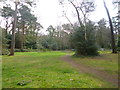
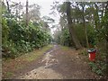
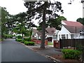
BH13 6BU sits within the Canford Cliffs ward, a small residential cluster covering just 1.3 hectares with a population of 1,837 people. This specific postcode area reflects the wider character of the district, an affluent seaside community that originated from Lord Wimborne's estate. The settlement began in 1886 when developers transformed open heathland into a structured village complete with estate roads and utilities. Originally designed for large south-facing plots, the area evolved significantly by the early 2000s when a shift occurred toward higher-density living. Today, many historic Victorian and Edwardian properties have been replaced by modern blocks of flats. The modern economy relies heavily on residential property and holiday lettings. You will find the area is defined by its history as a leisure destination, particularly known for watersports and shallow harbour waters ideal for sail boarding. While the Land Society was formed in 1925 to prevent commercial development, recent decades have seen the landscape change. Living in BH13 6BU means residing in a community that balances its historic seaside heritage with contemporary density. The area remains a hub for those seeking coast proximity, though the scope of permanent homes has contracted relative to holiday use. Historic landmarks like Holy Angels Church and the site of the old Martello Tower add to the local identity. You are looking at a place where the rugged coastline was once a smuggler's haven, now managed as a protective residential zone.
- Area Type
- Postcode
- Area Size
- 1.3 hectares
- Population
- 1837
- Population Density
- 1642 people/km²
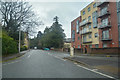
The property market in BH13 6BU is characterised by a shift away from traditional large houses toward higher-density housing solutions. Flats dominate the accommodation type for this postcode, a direct result of regeneration efforts in the 2000s where many original dwellings were replaced by modern blocks. You will find that less than half of the historic structures remained as permanent homes over two decades ago, while the rest were repurposed as holiday flats and second homes. This historical context influences the current market, where buyers often encounter a mix of original character homes and contemporary apartment blocks. Residential property drives the local economy, creating a market sustained by both permanent residents and those using the area for leisure. With a 69% home ownership rate, the area leans heavily toward owner-occupied stock rather than a rental-heavy model. This stability benefits the community feel but may limit availability for investors seeking rental yields. As you search for homes in BH13 6BU, expect to navigate a space where the original Edwardian planning has given way to modern development. The market reflects the ward's economic reliance on property and holiday lets, ensuring consistent demand through seasonal visitors and permanent families alike.
House Prices in BH13 6BU
Showing 4 properties
| Address | Type | Beds | Baths | Last Sale Price | Last Sale Date | |
|---|---|---|---|---|---|---|
| 8 Withingham Road, Poole, BH13 6BU | Detached | 5 | 5 | £1,625,000 | Dec 2018 | |
| 6 Withingham Road, Poole, BH13 6BU | Detached | 5 | 6 | £1,325,000 | Dec 2017 | |
| 9 Withingham Road, Poole, BH13 6BU | Detached | - | - | £1,925,000 | Mar 2017 | |
| 7 Withingham Road, Poole, BH13 6BU | Detached | 5 | 5 | £1,900,000 | Dec 2016 |
Energy Efficiency in BH13 6BU
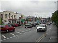
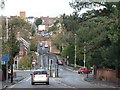
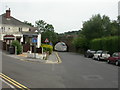
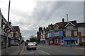
Residents of BH13 6BU enjoy access to a robust network of amenities within practical reach,儘管 the area itself is a compact residential cluster. For your daily shopping needs, Lidl Parkstone, Tesco Poole, and M&S Westbourne SF are available within the nearby retail category. These supermarkets provide fresh food and household essentials without requiring long journeys into Bournemouth or Poole city centre. Your transport links include five rail stations, with Branksome Railway Station, Parkstone Railway Station, and Bournemouth Railway Station forming the primary hubs. This network allows you to travel to the wider Poole and Bournemouth areas efficiently. For commuters and holidaymakers, the area benefits from five ferry locations, including Brownsea Island Ferry Landing and the Poole Quay Ferry Landing. Bournemouth International Airport is also within reach, though only two airports are listed in the immediate amenity data. The lifestyle revolves around convenience, with a parade of services historically located in Haven Road, though much has modernised. You can enjoy the seaside character while accessing major retail and transport networks just a short drive away. The area's leisure history supports water sports enthusiasts through its shallow harbour conditions.
Amenities
Schools
Families considering schools near BH13 6BU must type-factor their options carefully, as the immediate vicinity features predominantly special education provision. The nearest facility listed is the Victoria Education Centre, which operates as a special school. This establishment caters to pupils with specific educational needs rather than providing standard primary or secondary education for the general population. The presence of only one type of school in the immediate data highlights a reliance on a mixed education model, where families often commute to schools outside the postcode boundary. There are no comprehensive state schools or private academies listed in the immediate proximity of BH13 6BU. This indicates that parents should plan further than this small residential cluster to secure standard schooling options for their children. You may need to look toward larger towns like Poole or Bournemouth for standard curriculum provision. Living in BH13 6BU means accepting that local schooling is niche, requiring flexibility to access broader educational opportunities for your family.
| Rank | School | Type | Entry gender | Ages |
|---|
Explore more schools in this area
Go to Schools tabDemographics
The community settled in BH13 6BU reflects a mature profile with a median age of 47 years. Most residents fall into the adult bracket between 30 and 64 years old, indicating an established household base rather than a transient student population. Home ownership stands at 69%, showing that the majority of residents own their properties outright or have significant equity stakes. This high rate of ownership suggests long-term settlement intentions rather than short-term renting. The accommodation type for this postcode is predominantly flats, mirroring the broader trend identified in the ward where larger dwellings have been replaced by modern blocks. This shift impacts the type of buyer entering the market, focusing on multi-unit structures rather than detached homes. The predominant ethnic group is White, which aligns with traditional patterns for this affluent Dorset ward. Safety data indicates a medium crime risk with a score of 64 out of 100. This level of risk is around average for the region, meaning standard security precautions remain advisable. You do not face extreme danger, but you must remain vigilant as with any residential neighbourhood. The population density reaches 1,642 people per square kilometre, creating a shared community feel within this compact 1.3-hectare zone. Living here involves navigating a demographic that values stability and security within a historically wealthy seaside setting.
Household Size
Accommodation Type
Tenure
Ethnic Group
Religion
Household Composition
Age
Household Deprivation
NS-SEC
Explore more demographic insights in this area
Go to Demographics tabPlanning
Planning Constraints
- Flood RiskPremium
- Ramsar Wetland SitesPremium
- Area of Outstanding Natural BeautyPremium
- Protected Nature ReservePremium
- Protected WoodlandPremium